San Juan Texcalpan geodata
San Juan Texcalpan (Morelos) is a populated place; located in Mexico in America/Mexico_City (GMT-6) time zone. With population of 1,162 people, there are 7463 cities with bigger population in this country. Compared to other cities in Mexico, 66.1% of cities are located further ↑North; 51.5% of cities are located further ←West and 55.5% of cities have lower elevation than San Juan Texcalpan. Note1


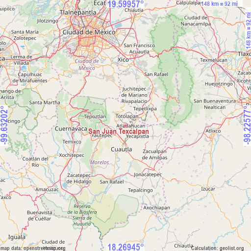
San Juan Texcalpan GPS coordinates[2]
18° 56' 8.988" North, 98° 55' 44.004" West
| Map corner | latitude | longitude |
|---|---|---|
| Upper-left | 19.59957°, | -99.63202° |
| Center: | 18.93583°, | -98.92889° |
| Lower-right: | 18.26945°, | -98.22577° |
| Map W x H: | 147.9×147.9 km | = 91.9×91.9mi |
| max Lat: | 32.7° ⇑66.1% North |
| San Juan Texcalpan: | 18.93583° |
| min Lat: | ⇓33.9% South 14.53588° |
| min Long | San Juan Texcal | max Long |
| -117.105° | -98.92889° | -86.73105° |
| W 51.5%⇐ | ⇒48.5% E |
Elevation
Elevation of San Juan Texcalpan is 1603 m = 5259 ft, and this is 349.3 m = 1146 ft above average elevation for this country.
| Max E: |
3497 m = 11473 ft | 44.5% |
| San Juan Texcalpan | 1603 m 5259 ft | |
| Avg. | 1253.7 m = 4113 ft | |
Min E: |
-1 m = -3 ft | 55.5% |
See also: Mexico elevation on elevation.city.
Geographical zone
San Juan Texcalpan is located in North Torrid zone (between Equator and Tropic of Cancer). Distance of this Northern Tropic circle is 500.5 km =311 mi to North.| Distance of | km | miles | from San Juan Texcalpan |
|---|---|---|---|
| North Pole | 7901.6 | 4909.8 | to North |
| Arctic Circle | 5295.7 | 3290.6 | to North |
| Tropic Cancer | 500.5 | 311 | to North |
| Equator | 2105.5 | 1308.3 | to South |


Nearby cities:
15 places around San Juan Texcalpan: (largest is in red/bold)
• Atlatlahucan
3.2 km =2 mi,  93°
93°
• Colonia Kilómetro 88
4.4 km =2.7 mi,  101°
101°
• Colonia Puente Pantitlán
6.6 km =4.1 mi,  255°
255°
• Colonia San Francisco
5.2 km =3.2 mi,  148°
148°
• Corral Grande
4.4 km =2.7 mi, 259°
• Cuauhtempan (San Andrés Cuauhtempan)
4.7 km =2.9 mi,  336°
336°
• Emiliano Zapata (Casahuates)
3.2 km =2 mi, 259°
• Las Minas
4.9 km =3 mi,  183°
183°
• Nacatongo
5.4 km =3.4 mi,  280°
280°
• Oaxtepec
3.5 km =2.2 mi,  235°
235°
• Rancho Cuachixolotera
5.6 km =3.5 mi,  207°
207°
• Tlaltetelco (San Miguel Tlaltetelco)
4.7 km =2.9 mi,  67°
67°
• Tlayacapan
5.9 km =3.7 mi,  291°
291°
• Totolapan
5.5 km =3.4 mi,  8°
8°
• Yecapixteca
6.6 km =4.1 mi,  155°
155°
Sources, notices
• [Note1] Compared only with cities in Mexico existing in our database
• [Src1] Map data: © OpenStreetMap contributors (CC-BY-SA)
• [Src2] Other city data from geonames.org with taken over terms of usage.
• [Src3] Geographical zone / Annual Mean Temperature by Robert A. Rohde @ Wikipedia
