Santiago Tetlapayac geodata
Santiago Tetlapayac (Hidalgo) is a populated place; located in Mexico in America/Mexico_City (GMT-6) time zone. With population of 750 people, there are 11679 cities with bigger population in this country. Compared to other cities in Mexico, 50.2% of cities are located further ↓South; 59.5% of cities are located further ←West and 93.7% of cities have lower elevation than Santiago Tetlapayac. Note1


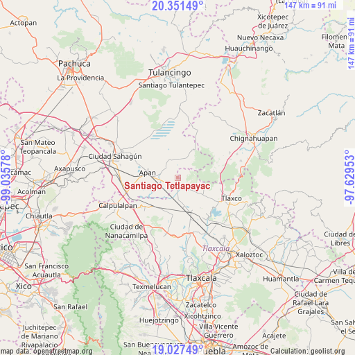
Santiago Tetlapayac GPS coordinates[2]
19° 41' 27.096" North, 98° 19' 57.54" West
| Map corner | latitude | longitude |
|---|---|---|
| Upper-left | 20.35149°, | -99.03578° |
| Center: | 19.69086°, | -98.33265° |
| Lower-right: | 19.02749°, | -97.62953° |
| Map W x H: | 147.2×147.2 km | = 91.5×91.5mi |
| max Lat: | 32.7° ⇑49.8% North |
| Santiago Tetlapayac: | 19.69086° |
| min Lat: | ⇓50.2% South 14.53588° |
| min Long | Santiago Tetlap | max Long |
| -117.105° | -98.33265° | -86.73105° |
| W 59.5%⇐ | ⇒40.5% E |
Elevation
Elevation of Santiago Tetlapayac is 2558 m = 8392 ft, and this is 1304.3 m = 4279 ft above average elevation for this country.
| Max E: |
3497 m = 11473 ft | 6.3% |
| Santiago Tetlapayac | 2558 m 8392 ft | |
| Avg. | 1253.7 m = 4113 ft | |
Min E: |
-1 m = -3 ft | 93.7% |
See also: Mexico elevation on elevation.city.
Geographical zone
Santiago Tetlapayac is located in North Torrid zone (between Equator and Tropic of Cancer). Distance of this Northern Tropic circle is 416.5 km =258.8 mi to North.| Distance of | km | miles | from Santiago Tetlapayac |
|---|---|---|---|
| North Pole | 7817.6 | 4857.6 | to North |
| Arctic Circle | 5211.8 | 3238.5 | to North |
| Tropic Cancer | 416.5 | 258.8 | to North |
| Equator | 2189.4 | 1360.4 | to South |


Nearby cities:
15 places around Santiago Tetlapayac: (largest is in red/bold)
• Almoloya
7.6 km =4.7 mi,  281°
281°
• Casa Blanca
10.1 km =6.3 mi,  108°
108°
• El Rosario
11.4 km =7.1 mi, 106°
• Jiquilpan
9.1 km =5.7 mi,  219°
219°
• La Magdalena Soltepec
12.4 km =7.7 mi,  170°
170°
• Lagunilla
8.6 km =5.3 mi,  134°
134°
• Mariano Matamoros
6.9 km =4.3 mi,  123°
123°
• Ocotepec
10.5 km =6.5 mi,  273°
273°
• Ocotepec de Morelos
5.3 km =3.3 mi,  248°
248°
• Rancho Nuevo
8.4 km =5.2 mi,  41°
41°
• San José Tepeyahualco
12.2 km =7.6 mi,  146°
146°
• San Juan Ixtilmaco
12.5 km =7.8 mi,  257°
257°
• San Lorenzo Sóltepec
9.8 km =6.1 mi, 168°
• Tepepatlaxco
8 km =5 mi,  329°
329°
• Unión Ejidal Tierra y Libertad
3.7 km =2.3 mi,  187°
187°
Sources, notices
• [Note1] Compared only with cities in Mexico existing in our database
• [Src1] Map data: © OpenStreetMap contributors (CC-BY-SA)
• [Src2] Other city data from geonames.org with taken over terms of usage.
• [Src3] Geographical zone / Annual Mean Temperature by Robert A. Rohde @ Wikipedia
