Coamitla geodata
Coamitla (Hidalgo) is a populated place; located in Mexico in America/Mexico_City (GMT-6) time zone. With population of 704 people, there are 12362 cities with bigger population in this country. Compared to other cities in Mexico, 74.8% of cities are located further ↓South; 57.3% of cities are located further ←West and 63% of cities have higher elevation than Coamitla. Note1


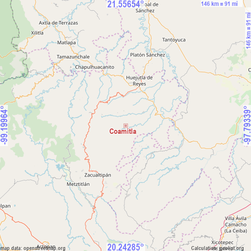
Coamitla GPS coordinates[2]
20° 54' 4.068" North, 98° 29' 47.436" West
| Map corner | latitude | longitude |
|---|---|---|
| Upper-left | 21.55654°, | -99.19964° |
| Center: | 20.90113°, | -98.49651° |
| Lower-right: | 20.24285°, | -97.79339° |
| Map W x H: | 146.1×146.1 km | = 90.8×90.8mi |
| max Lat: | 32.7° ⇑25.2% North |
| Coamitla: | 20.90113° |
| min Lat: | ⇓74.8% South 14.53588° |
| min Long | Coamitla | max Long |
| -117.105° | -98.49651° | -86.73105° |
| W 57.3%⇐ | ⇒42.7% E |
Elevation
Elevation of Coamitla is 821 m = 2694 ft, and this is 432.7 m = 1420 ft below average elevation for this country.
| Max E: |
3497 m = 11473 ft | 63% |
| Avg. | 1253.7 m = 4113 ft | |
| Coamitla | 821 m = 2694 ft | |
Min E: |
-1 m = -3 ft | 37% |
See also: Mexico elevation on elevation.city.
Geographical zone
Coamitla is located in North Torrid zone (between Equator and Tropic of Cancer). Distance of this Northern Tropic circle is 281.9 km =175.2 mi to North.| Distance of | km | miles | from Coamitla |
|---|---|---|---|
| North Pole | 7683.1 | 4774.1 | to North |
| Arctic Circle | 5077.2 | 3154.8 | to North |
| Tropic Cancer | 281.9 | 175.2 | to North |
| Equator | 2324 | 1444.1 | to South |


Nearby cities:
15 places around Coamitla: (largest is in red/bold)
• Aguacatitla
8.4 km =5.2 mi,  121°
121°
• Atempa
2.1 km =1.3 mi,  161°
161°
• Calnali
9.2 km =5.7 mi,  267°
267°
• Coacoaco
10.3 km =6.4 mi,  142°
142°
• Coyula
3.1 km =1.9 mi,  26°
26°
• Huazalingo
8.9 km =5.5 mi,  352°
352°
• Papatlatla
4.6 km =2.9 mi,  89°
89°
• Pilcuatla
7.8 km =4.8 mi,  314°
314°
• San Andrés (San Andrés Chichayotla)
7.5 km =4.7 mi,  292°
292°
• Santa Lucía (Mesa de Santa Lucía)
7.4 km =4.6 mi,  58°
58°
• Tlamamala
8.9 km =5.5 mi,  328°
328°
• Tuzancoac
7.9 km =4.9 mi,  229°
229°
• Xoxolpa
8.1 km =5 mi,  110°
110°
• Zacatipán
7.2 km =4.5 mi,  191°
191°
• Zoquitipán
6.7 km =4.2 mi,  82°
82°
Sources, notices
• [Note1] Compared only with cities in Mexico existing in our database
• [Src1] Map data: © OpenStreetMap contributors (CC-BY-SA)
• [Src2] Other city data from geonames.org with taken over terms of usage.
• [Src3] Geographical zone / Annual Mean Temperature by Robert A. Rohde @ Wikipedia
