Tancoco geodata
Tancoco (Veracruz) is a seat of a second-order administrative division; located in Mexico in America/Mexico_City (GMT-6) time zone. With population of 1,548 people, there are 5570 cities with bigger population in this country. Compared to other cities in Mexico, 79.9% of cities are located further ↓South; 66.2% of cities are located further ←West and 74.1% of cities have higher elevation than Tancoco. Note1


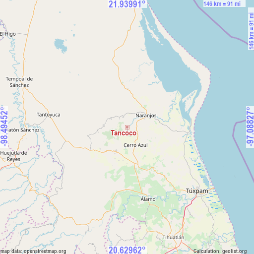
Tancoco GPS coordinates[2]
21° 17' 10.392" North, 97° 47' 29.004" West
| Map corner | latitude | longitude |
|---|---|---|
| Upper-left | 21.93991°, | -98.49452° |
| Center: | 21.28622°, | -97.79139° |
| Lower-right: | 20.62962°, | -97.08827° |
| Map W x H: | 145.7×145.7 km | = 90.5×90.5mi |
| max Lat: | 32.7° ⇑20.1% North |
| Tancoco: | 21.28622° |
| min Lat: | ⇓79.9% South 14.53588° |
| min Long | Tancoco | max Long |
| -117.105° | -97.79139° | -86.73105° |
| W 66.2%⇐ | ⇒33.8% E |
Elevation
Elevation of Tancoco is 251 m = 823 ft, and this is 1002.7 m = 3290 ft below average elevation for this country.
| Max E: |
3497 m = 11473 ft | 74.1% |
| Avg. | 1253.7 m = 4113 ft | |
| Tancoco | 251 m = 823 ft | |
Min E: |
-1 m = -3 ft | 25.9% |
See also: Mexico elevation on elevation.city.
Geographical zone
Tancoco is located in North Torrid zone (between Equator and Tropic of Cancer). Distance of this Northern Tropic circle is 239.1 km =148.6 mi to North.| Distance of | km | miles | from Tancoco |
|---|---|---|---|
| North Pole | 7640.3 | 4747.5 | to North |
| Arctic Circle | 5034.4 | 3128.2 | to North |
| Tropic Cancer | 239.1 | 148.6 | to North |
| Equator | 2366.8 | 1470.7 | to South |


Nearby cities:
15 places around Tancoco: (largest is in red/bold)
• Amatlán
6.5 km =4 mi,  33°
33°
• Carmona y Valle
8.3 km =5.2 mi,  357°
357°
• Cerro Azul
11.7 km =7.3 mi,  153°
153°
• Cervantes
10.2 km =6.3 mi,  58°
58°
• Chinampa de Gorostiza
10 km =6.2 mi,  35°
35°
• Citlaltépec
10.2 km =6.3 mi,  297°
297°
• El Naranjal
11.6 km =7.2 mi, 297°
• Galeana
10.4 km =6.5 mi,  86°
86°
• Gutiérrez Zamora
9.1 km =5.7 mi, 355°
• Las Sabinas
9.9 km =6.2 mi,  290°
290°
• Naranjos
13 km =8.1 mi, 56°
• Piedra Labrada
10.2 km =6.3 mi,  181°
181°
• Tamalín
6.3 km =3.9 mi,  340°
340°
• Tantima
6.7 km =4.2 mi,  319°
319°
• Zacamixtle
8.4 km =5.2 mi,  120°
120°
Sources, notices
• [Note1] Compared only with cities in Mexico existing in our database
• [Src1] Map data: © OpenStreetMap contributors (CC-BY-SA)
• [Src2] Other city data from geonames.org with taken over terms of usage.
• [Src3] Geographical zone / Annual Mean Temperature by Robert A. Rohde @ Wikipedia
