Piedra Labrada geodata
Piedra Labrada (Veracruz) is a populated place; located in Mexico in America/Mexico_City (GMT-6) time zone. With population of 592 people, there are 14508 cities with bigger population in this country. Compared to other cities in Mexico, 79.1% of cities are located further ↓South; 66.2% of cities are located further ←West and 74.9% of cities have higher elevation than Piedra Labrada. Note1


Piedra Labrada GPS coordinates[2]
21° 11' 41.748" North, 97° 47' 39.012" West
| Map corner | latitude | longitude |
|---|---|---|
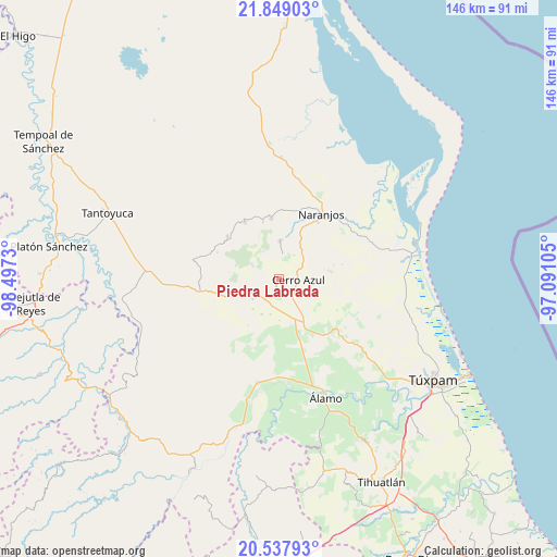
| Upper-left | 21.84903°, | -98.4973° |
| Center: | 21.19493°, | -97.79417° |
| Lower-right: | 20.53793°, | -97.09105° |
| Map W x H: | 145.8×145.8 km | = 90.6×90.6mi |
| max Lat: | 32.7° ⇑20.9% North |
| Piedra Labrada: | 21.19493° |
| min Lat: | ⇓79.1% South 14.53588° |
| min Long | Piedra Labrada | max Long |
| -117.105° | -97.79417° | -86.73105° |
| W 66.2%⇐ | ⇒33.8% E |
Elevation
Elevation of Piedra Labrada is 224 m = 735 ft, and this is 1029.7 m = 3378 ft below average elevation for this country.
| Max E: |
3497 m = 11473 ft | 74.9% |
| Avg. | 1253.7 m = 4113 ft | |
| Piedra Labrada | 224 m = 735 ft | |
Min E: |
-1 m = -3 ft | 25.1% |
See also: Mexico elevation on elevation.city.
Geographical zone
Piedra Labrada is located in North Torrid zone (between Equator and Tropic of Cancer). Distance of this Northern Tropic circle is 249.3 km =154.9 mi to North.| Distance of | km | miles | from Piedra Labrada |
|---|---|---|---|
| North Pole | 7650.4 | 4753.7 | to North |
| Arctic Circle | 5044.5 | 3134.5 | to North |
| Tropic Cancer | 249.3 | 154.9 | to North |
| Equator | 2356.7 | 1464.4 | to South |


Nearby cities:
15 places around Piedra Labrada: (largest is in red/bold)
• Cerro Azul
5.5 km =3.4 mi,  93°
93°
• Copaltitla
8.4 km =5.2 mi,  262°
262°
• El Cafetal
14.4 km =8.9 mi, 88°
• El Humo
15.4 km =9.6 mi, 262°
• Galeana
15.2 km =9.4 mi,  45°
45°
• Horcones
14.7 km =9.1 mi,  159°
159°
• Juan Felipe
5.2 km =3.2 mi,  149°
149°
• La Guásima
10.1 km =6.3 mi,  206°
206°
• Potrero del Llano
14.5 km =9 mi, 151°
• Tancoco
10.2 km =6.3 mi,  1°
1°
• Tecomate
8.5 km =5.3 mi,  233°
233°
• Tepetzintla
6.9 km =4.3 mi,  240°
240°
• Tierra Blanca
13.6 km =8.5 mi,  253°
253°
• Zacamixtle
9.5 km =5.9 mi, 52°
• Zapotitlán
9.4 km =5.8 mi,  193°
193°
Sources, notices
• [Note1] Compared only with cities in Mexico existing in our database
• [Src1] Map data: © OpenStreetMap contributors (CC-BY-SA)
• [Src2] Other city data from geonames.org with taken over terms of usage.
• [Src3] Geographical zone / Annual Mean Temperature by Robert A. Rohde @ Wikipedia
