Tamala geodata
Tamala (Hidalgo) is a populated place; located in Mexico in America/Mexico_City (GMT-6) time zone. With population of 709 people, there are 12279 cities with bigger population in this country. Compared to other cities in Mexico, 76.4% of cities are located further ↓South; 53.6% of cities are located further ←West and 71.7% of cities have higher elevation than Tamala. Note1


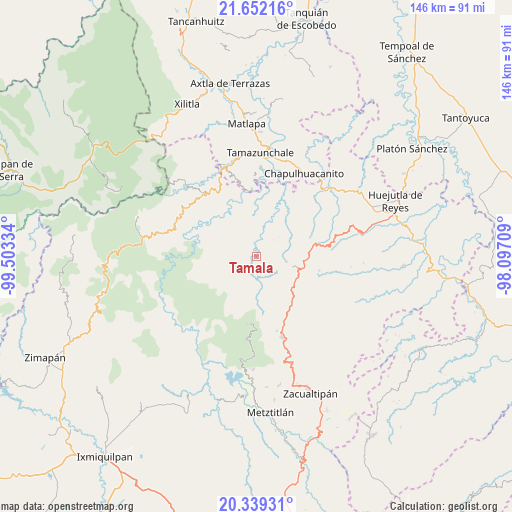
Tamala GPS coordinates[2]
20° 59' 49.848" North, 98° 48' 0.756" West
| Map corner | latitude | longitude |
|---|---|---|
| Upper-left | 21.65216°, | -99.50334° |
| Center: | 20.99718°, | -98.80021° |
| Lower-right: | 20.33931°, | -98.09709° |
| Map W x H: | 146×146 km | = 90.7×90.7mi |
| max Lat: | 32.7° ⇑23.6% North |
| Tamala: | 20.99718° |
| min Lat: | ⇓76.4% South 14.53588° |
| min Long | Tamala | max Long |
| -117.105° | -98.80021° | -86.73105° |
| W 53.6%⇐ | ⇒46.4% E |
Elevation
Elevation of Tamala is 337 m = 1106 ft, and this is 916.7 m = 3008 ft below average elevation for this country.
| Max E: |
3497 m = 11473 ft | 71.7% |
| Avg. | 1253.7 m = 4113 ft | |
| Tamala | 337 m = 1106 ft | |
Min E: |
-1 m = -3 ft | 28.3% |
See also: Mexico elevation on elevation.city.
Geographical zone
Tamala is located in North Torrid zone (between Equator and Tropic of Cancer). Distance of this Northern Tropic circle is 271.3 km =168.6 mi to North.| Distance of | km | miles | from Tamala |
|---|---|---|---|
| North Pole | 7672.4 | 4767.4 | to North |
| Arctic Circle | 5066.5 | 3148.2 | to North |
| Tropic Cancer | 271.3 | 168.6 | to North |
| Equator | 2334.7 | 1450.7 | to South |


Nearby cities:
15 places around Tamala: (largest is in red/bold)
• Acayuca
4.1 km =2.5 mi,  150°
150°
• Acoxcatlán
3.5 km =2.2 mi,  138°
138°
• Acuimantla
4.3 km =2.7 mi,  4°
4°
• Aquilastec
4.8 km =3 mi,  64°
64°
• Chilijapa
7.4 km =4.6 mi,  281°
281°
• Cuazahuatl
9.2 km =5.7 mi, 283°
• Cuxhuacan
3.4 km =2.1 mi,  211°
211°
• Ixculculla
6 km =3.7 mi,  228°
228°
• Ixtlapala
8.4 km =5.2 mi,  73°
73°
• San Miguel Ayotempa
5.7 km =3.5 mi,  246°
246°
• Tepehuacán de Guerrero
4.7 km =2.9 mi,  292°
292°
• Teyahuala
7.5 km =4.7 mi,  321°
321°
• Tolago
7.8 km =4.8 mi,  105°
105°
• Xilitla
8.2 km =5.1 mi,  354°
354°
• Xuchitlán
9.4 km =5.8 mi,  38°
38°
Sources, notices
• [Note1] Compared only with cities in Mexico existing in our database
• [Src1] Map data: © OpenStreetMap contributors (CC-BY-SA)
• [Src2] Other city data from geonames.org with taken over terms of usage.
• [Src3] Geographical zone / Annual Mean Temperature by Robert A. Rohde @ Wikipedia
