Chilijapa geodata
Chilijapa (Hidalgo) is a populated place; located in Mexico in America/Mexico_City (GMT-6) time zone. With population of 905 people, there are 9644 cities with bigger population in this country. Compared to other cities in Mexico, 76.6% of cities are located further ↓South; 52.5% of cities are located further ←West and 50.5% of cities have higher elevation than Chilijapa. Note1


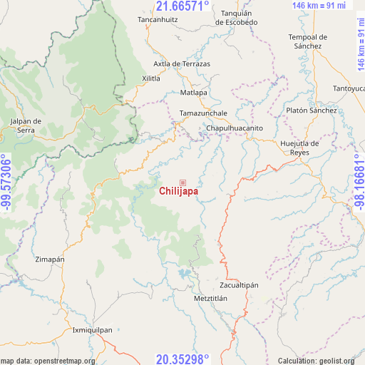
Chilijapa GPS coordinates[2]
21° 0' 38.844" North, 98° 52' 11.748" West
| Map corner | latitude | longitude |
|---|---|---|
| Upper-left | 21.66571°, | -99.57306° |
| Center: | 21.01079°, | -98.86993° |
| Lower-right: | 20.35298°, | -98.16681° |
| Map W x H: | 146×146 km | = 90.7×90.7mi |
| max Lat: | 32.7° ⇑23.4% North |
| Chilijapa: | 21.01079° |
| min Lat: | ⇓76.6% South 14.53588° |
| min Long | Chilijapa | max Long |
| -117.105° | -98.86993° | -86.73105° |
| W 52.5%⇐ | ⇒47.5% E |
Elevation
Elevation of Chilijapa is 1403 m = 4603 ft, and this is 149.3 m = 490 ft above average elevation for this country.
| Max E: |
3497 m = 11473 ft | 50.5% |
| Chilijapa | 1403 m 4603 ft | |
| Avg. | 1253.7 m = 4113 ft | |
Min E: |
-1 m = -3 ft | 49.5% |
See also: Mexico elevation on elevation.city.
Geographical zone
Chilijapa is located in North Torrid zone (between Equator and Tropic of Cancer). Distance of this Northern Tropic circle is 269.7 km =167.6 mi to North.| Distance of | km | miles | from Chilijapa |
|---|---|---|---|
| North Pole | 7670.9 | 4766.5 | to North |
| Arctic Circle | 5065 | 3147.2 | to North |
| Tropic Cancer | 269.7 | 167.6 | to North |
| Equator | 2336.2 | 1451.6 | to South |


Nearby cities:
15 places around Chilijapa: (largest is in red/bold)
• Acuimantla
8.1 km =5 mi,  70°
70°
• Ahuatetla
5.8 km =3.6 mi,  307°
307°
• Amola de Ocampo
7.3 km =4.5 mi,  338°
338°
• Coyocala
7.2 km =4.5 mi,  204°
204°
• Cuazahuatl
1.9 km =1.2 mi,  289°
289°
• Cuxhuacan
7 km =4.3 mi,  129°
129°
• Ixculculla
6.2 km =3.9 mi,  153°
153°
• La Reforma
6.9 km =4.3 mi,  359°
359°
• San Juan Ahuehueco
5.2 km =3.2 mi, 311°
• San Miguel Ayotempa
4.3 km =2.7 mi, 152°
• Tamala
7.4 km =4.6 mi,  101°
101°
• Tenango
8.1 km =5 mi, 309°
• Tepehuacán de Guerrero
2.9 km =1.8 mi,  84°
84°
• Teyahuala
5.1 km =3.2 mi,  30°
30°
• Xuchiatipa
8.5 km =5.3 mi,  276°
276°
Sources, notices
• [Note1] Compared only with cities in Mexico existing in our database
• [Src1] Map data: © OpenStreetMap contributors (CC-BY-SA)
• [Src2] Other city data from geonames.org with taken over terms of usage.
• [Src3] Geographical zone / Annual Mean Temperature by Robert A. Rohde @ Wikipedia
