Ixculculla geodata
Ixculculla (Hidalgo) is a populated place; located in Mexico in America/Mexico_City (GMT-6) time zone. With population of 519 people, there are 16226 cities with bigger population in this country. Compared to other cities in Mexico, 75.9% of cities are located further ↓South; 52.9% of cities are located further ←West and 54.2% of cities have higher elevation than Ixculculla. Note1


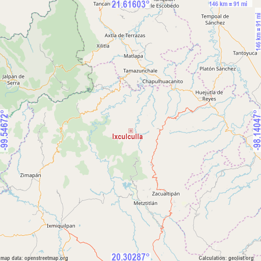
Ixculculla GPS coordinates[2]
20° 57' 39.204" North, 98° 50' 36.924" West
| Map corner | latitude | longitude |
|---|---|---|
| Upper-left | 21.61603°, | -99.54672° |
| Center: | 20.96089°, | -98.84359° |
| Lower-right: | 20.30287°, | -98.14047° |
| Map W x H: | 146×146 km | = 90.7×90.7mi |
| max Lat: | 32.7° ⇑24.1% North |
| Ixculculla: | 20.96089° |
| min Lat: | ⇓75.9% South 14.53588° |
| min Long | Ixculculla | max Long |
| -117.105° | -98.84359° | -86.73105° |
| W 52.9%⇐ | ⇒47.1% E |
Elevation
Elevation of Ixculculla is 1234 m = 4049 ft, and this is 19.7 m = 65 ft below average elevation for this country.
| Max E: |
3497 m = 11473 ft | 54.2% |
| Avg. | 1253.7 m = 4113 ft | |
| Ixculculla | 1234 m = 4049 ft | |
Min E: |
-1 m = -3 ft | 45.8% |
See also: Mexico elevation on elevation.city.
Geographical zone
Ixculculla is located in North Torrid zone (between Equator and Tropic of Cancer). Distance of this Northern Tropic circle is 275.3 km =171.1 mi to North.| Distance of | km | miles | from Ixculculla |
|---|---|---|---|
| North Pole | 7676.4 | 4769.9 | to North |
| Arctic Circle | 5070.5 | 3150.7 | to North |
| Tropic Cancer | 275.3 | 171.1 | to North |
| Equator | 2330.6 | 1448.2 | to South |


Nearby cities:
15 places around Ixculculla: (largest is in red/bold)
• Acayuca
6.6 km =4.1 mi,  85°
85°
• Acoxcatlán
7 km =4.3 mi,  78°
78°
• Acuimantla
9.6 km =6 mi,  30°
30°
• Aquilastec
10.8 km =6.7 mi,  55°
55°
• Chilijapa
6.2 km =3.9 mi,  333°
333°
• Coyocala
5.8 km =3.6 mi,  259°
259°
• Cuazahuatl
7.6 km =4.7 mi,  323°
323°
• Cuxhuacan
2.9 km =1.8 mi,  68°
68°
• San Antonio
7.8 km =4.8 mi,  172°
172°
• San Juan Ahuehueco
11.1 km =6.9 mi, 323°
• San Miguel Ayotempa
1.9 km =1.2 mi,  336°
336°
• San Nicolás Cuatzontla
10.2 km =6.3 mi,  183°
183°
• Tamala
6 km =3.7 mi,  48°
48°
• Tepehuacán de Guerrero
5.9 km =3.7 mi,  1°
1°
• Teyahuala
9.9 km =6.2 mi,  359°
359°
Sources, notices
• [Note1] Compared only with cities in Mexico existing in our database
• [Src1] Map data: © OpenStreetMap contributors (CC-BY-SA)
• [Src2] Other city data from geonames.org with taken over terms of usage.
• [Src3] Geographical zone / Annual Mean Temperature by Robert A. Rohde @ Wikipedia
