San Vicente Lachixío geodata
San Vicente Lachixío (Oaxaca) is a seat of a second-order administrative division; located in Mexico in America/Mexico_City (GMT-6) time zone. With population of 1,295 people, there are 6689 cities with bigger population in this country. Compared to other cities in Mexico, 92.8% of cities are located further ↑North; 74.6% of cities are located further ←West and 82.5% of cities have lower elevation than San Vicente Lachixío. Note1


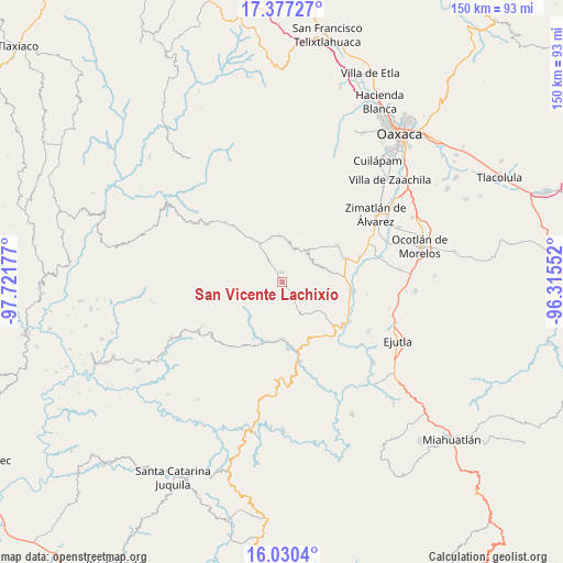
San Vicente Lachixío GPS coordinates[2]
16° 42' 18.072" North, 97° 1' 7.104" West
| Map corner | latitude | longitude |
|---|---|---|
| Upper-left | 17.37727°, | -97.72177° |
| Center: | 16.70502°, | -97.01864° |
| Lower-right: | 16.0304°, | -96.31552° |
| Map W x H: | 149.8×149.8 km | = 93.1×93.1mi |
| max Lat: | 32.7° ⇑92.8% North |
| San Vicente Lachixío: | 16.70502° |
| min Lat: | ⇓7.2% South 14.53588° |
| min Long | San Vicente Lac | max Long |
| -117.105° | -97.01864° | -86.73105° |
| W 74.6%⇐ | ⇒25.4% E |
Elevation
Elevation of San Vicente Lachixío is 2203 m = 7228 ft, and this is 949.3 m = 3115 ft above average elevation for this country.
| Max E: |
3497 m = 11473 ft | 17.5% |
| San Vicente Lachixío | 2203 m 7228 ft | |
| Avg. | 1253.7 m = 4113 ft | |
Min E: |
-1 m = -3 ft | 82.5% |
See also: Mexico elevation on elevation.city.
Geographical zone
San Vicente Lachixío is located in North Torrid zone (between Equator and Tropic of Cancer). Distance of this Northern Tropic circle is 748.5 km =465.1 mi to North.| Distance of | km | miles | from San Vicente Lachixío |
|---|---|---|---|
| North Pole | 8149.6 | 5063.9 | to North |
| Arctic Circle | 5543.7 | 3444.7 | to North |
| Tropic Cancer | 748.5 | 465.1 | to North |
| Equator | 1857.4 | 1154.1 | to South |


Nearby cities:
15 places around San Vicente Lachixío: (largest is in red/bold)
• Agua Fría Campanario
12 km =7.5 mi,  69°
69°
• Ayoquezco de Aldama
18.9 km =11.7 mi,  97°
97°
• Emiliano Zapata
20.7 km =12.9 mi, 72°
• San Bernardo Mixtepec
18.5 km =11.5 mi,  43°
43°
• San Mateo Mixtepec
11.9 km =7.4 mi, 42°
• San Miguel Mixtepec
10.3 km =6.4 mi, 39°
• San Pedro el Alto
12.1 km =7.5 mi,  342°
342°
• San Sebastián de las Grutas
10.4 km =6.5 mi,  141°
141°
• Santa Ana Tlapacoyan
19.8 km =12.3 mi,  77°
77°
• Santa Cruz Mixtepec
17.6 km =10.9 mi,  56°
56°
• Santa Cruz Nexila
19.6 km =12.2 mi,  113°
113°
• Santa María Lachixío
2.4 km =1.5 mi,  359°
359°
• Santa María Sola
15.5 km =9.6 mi,  177°
177°
• Santa Rosa Matagallinas
13 km =8.1 mi, 180°
• Trapiche Santa Cruz
18.6 km =11.6 mi, 70°
Sources, notices
• [Note1] Compared only with cities in Mexico existing in our database
• [Src1] Map data: © OpenStreetMap contributors (CC-BY-SA)
• [Src2] Other city data from geonames.org with taken over terms of usage.
• [Src3] Geographical zone / Annual Mean Temperature by Robert A. Rohde @ Wikipedia
