San Vicente Coatlán geodata
San Vicente Coatlán (Oaxaca) is a seat of a second-order administrative division; located in Mexico in America/Mexico_City (GMT-6) time zone. With population of 3,606 people, there are 2543 cities with bigger population in this country. Compared to other cities in Mexico, 95.1% of cities are located further ↑North; 76.7% of cities are located further ←West and 51.1% of cities have higher elevation than San Vicente Coatlán. Note1


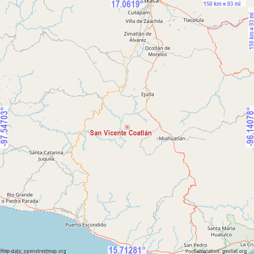
San Vicente Coatlán GPS coordinates[2]
16° 23' 18.672" North, 96° 50' 38.04" West
| Map corner | latitude | longitude |
|---|---|---|
| Upper-left | 17.0619°, | -97.54703° |
| Center: | 16.38852°, | -96.8439° |
| Lower-right: | 15.71281°, | -96.14078° |
| Map W x H: | 150×150 km | = 93.2×93.2mi |
| max Lat: | 32.7° ⇑95.1% North |
| San Vicente Coatlán: | 16.38852° |
| min Lat: | ⇓4.9% South 14.53588° |
| min Long | San Vicente Coa | max Long |
| -117.105° | -96.8439° | -86.73105° |
| W 76.7%⇐ | ⇒23.3% E |
Elevation
Elevation of San Vicente Coatlán is 1379 m = 4524 ft, and this is 125.3 m = 411 ft above average elevation for this country.
| Max E: |
3497 m = 11473 ft | 51.1% |
| San Vicente Coatlán | 1379 m 4524 ft | |
| Avg. | 1253.7 m = 4113 ft | |
Min E: |
-1 m = -3 ft | 48.9% |
See also: Mexico elevation on elevation.city.
Geographical zone
San Vicente Coatlán is located in North Torrid zone (between Equator and Tropic of Cancer). Distance of this Northern Tropic circle is 783.7 km =487 mi to North.| Distance of | km | miles | from San Vicente Coatlán |
|---|---|---|---|
| North Pole | 8184.8 | 5085.8 | to North |
| Arctic Circle | 5578.9 | 3466.6 | to North |
| Tropic Cancer | 783.7 | 487 | to North |
| Equator | 1822.2 | 1132.3 | to South |


Nearby cities:
15 places around San Vicente Coatlán: (largest is in red/bold)
• Agua del Sol
15.1 km =9.4 mi,  52°
52°
• Barranca Larga
16.7 km =10.4 mi, 45°
• El Zompantle
19.6 km =12.2 mi,  72°
72°
• Guixé
17.6 km =10.9 mi,  58°
58°
• Hacienda Vieja
19.1 km =11.9 mi,  28°
28°
• La Compañía
19 km =11.8 mi,  7°
7°
• San Agustín Amatengo
14.8 km =9.2 mi,  23°
23°
• San Jerónimo Coatlán
17.6 km =10.9 mi,  189°
189°
• San Nicolás
11.5 km =7.1 mi, 72°
• San Pablo Coatlán
19.4 km =12.1 mi,  160°
160°
• San Pedro Coatlán
18.3 km =11.4 mi,  144°
144°
• San Simón Almolongas
13.4 km =8.3 mi,  81°
81°
• Santa Ana
14.5 km =9 mi,  111°
111°
• Santa Catarina Coatlán
12.4 km =7.7 mi, 143°
• Santiago Yogana
10.1 km =6.3 mi,  36°
36°
Sources, notices
• [Note1] Compared only with cities in Mexico existing in our database
• [Src1] Map data: © OpenStreetMap contributors (CC-BY-SA)
• [Src2] Other city data from geonames.org with taken over terms of usage.
• [Src3] Geographical zone / Annual Mean Temperature by Robert A. Rohde @ Wikipedia
