Santa Catarina Coatlán geodata
Santa Catarina Coatlán (Oaxaca) is a populated place; located in Mexico in America/Mexico_City (GMT-6) time zone. With population of 570 people, there are 15008 cities with bigger population in this country. Compared to other cities in Mexico, 95.7% of cities are located further ↑North; 77.6% of cities are located further ←West and 58.4% of cities have lower elevation than Santa Catarina Coatlán. Note1


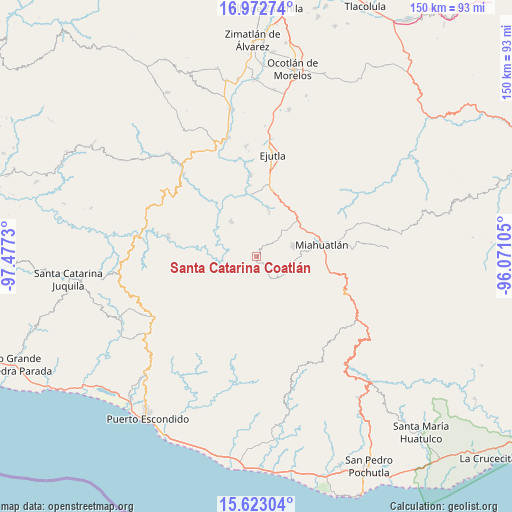
Santa Catarina Coatlán GPS coordinates[2]
16° 17' 56.58" North, 96° 46' 27.012" West
| Map corner | latitude | longitude |
|---|---|---|
| Upper-left | 16.97274°, | -97.4773° |
| Center: | 16.29905°, | -96.77417° |
| Lower-right: | 15.62304°, | -96.07105° |
| Map W x H: | 150.1×150.1 km | = 93.3×93.3mi |
| max Lat: | 32.7° ⇑95.7% North |
| Santa Catarina Coatlán: | 16.29905° |
| min Lat: | ⇓4.3% South 14.53588° |
| min Long | Santa Catarina | max Long |
| -117.105° | -96.77417° | -86.73105° |
| W 77.6%⇐ | ⇒22.4% E |
Elevation
Elevation of Santa Catarina Coatlán is 1696 m = 5564 ft, and this is 442.3 m = 1451 ft above average elevation for this country.
| Max E: |
3497 m = 11473 ft | 41.6% |
| Santa Catarina Coatlán | 1696 m 5564 ft | |
| Avg. | 1253.7 m = 4113 ft | |
Min E: |
-1 m = -3 ft | 58.4% |
See also: Mexico elevation on elevation.city.
Geographical zone
Santa Catarina Coatlán is located in North Torrid zone (between Equator and Tropic of Cancer). Distance of this Northern Tropic circle is 793.6 km =493.1 mi to North.| Distance of | km | miles | from Santa Catarina Coatlán |
|---|---|---|---|
| North Pole | 8194.8 | 5092 | to North |
| Arctic Circle | 5588.9 | 3472.8 | to North |
| Tropic Cancer | 793.6 | 493.1 | to North |
| Equator | 1812.3 | 1126.1 | to South |


Nearby cities:
15 places around Santa Catarina Coatlán: (largest is in red/bold)
• Monjas
16.2 km =10.1 mi,  60°
60°
• San Francisco Coatlán
13.1 km =8.1 mi,  173°
173°
• San Jerónimo Coatlán
12.7 km =7.9 mi,  234°
234°
• San Miguel Coatlán
14.2 km =8.8 mi,  143°
143°
• San Miguel Yogovana
15.4 km =9.6 mi,  98°
98°
• San Nicolás
13.9 km =8.6 mi,  14°
14°
• San Pablo Coatlán
8.4 km =5.2 mi,  187°
187°
• San Pedro Coatlán
5.9 km =3.7 mi,  147°
147°
• San Sebastián Coatlán
12.1 km =7.5 mi,  207°
207°
• San Simón Almolongas
13.3 km =8.3 mi,  26°
26°
• San Vicente Coatlán
12.4 km =7.7 mi,  323°
323°
• Santa Ana
7.7 km =4.8 mi,  52°
52°
• Santa Catarina Cuixtla
14.1 km =8.8 mi,  86°
86°
• Santa Cruz Xitla
11.1 km =6.9 mi,  75°
75°
• Santiago Yogana
18.1 km =11.2 mi,  355°
355°
Sources, notices
• [Note1] Compared only with cities in Mexico existing in our database
• [Src1] Map data: © OpenStreetMap contributors (CC-BY-SA)
• [Src2] Other city data from geonames.org with taken over terms of usage.
• [Src3] Geographical zone / Annual Mean Temperature by Robert A. Rohde @ Wikipedia
