Santo Domingo Huehuetlán geodata
Santo Domingo Huehuetlán (Puebla) is a seat of a second-order administrative division; located in Mexico in America/Mexico_City (GMT-6) time zone. With population of 2,477 people, there are 3570 cities with bigger population in this country. Compared to other cities in Mexico, 69.7% of cities are located further ↑North; 61.7% of cities are located further ←West and 51.5% of cities have higher elevation than Santo Domingo Huehuetlán. Note1
Current local time in Santo Domingo Huehuetlán:
11:16 AM, MondayDifference from your time zone: hours


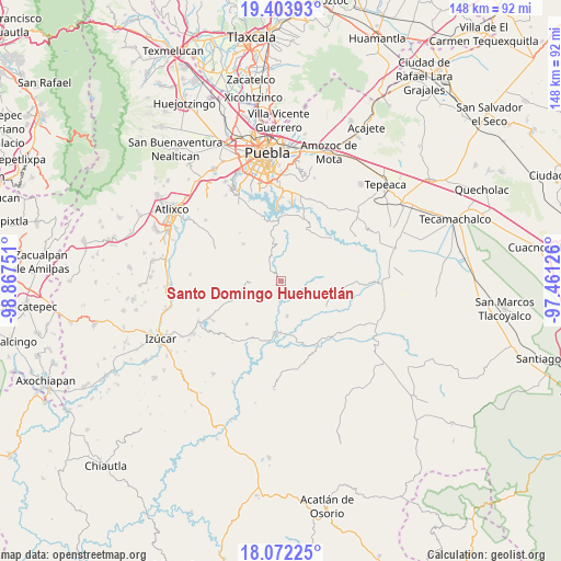
Santo Domingo Huehuetlán GPS coordinates[2]
18° 44' 21.84" North, 98° 9' 51.768" West
| Map corner | latitude | longitude |
|---|---|---|
| Upper-left | 19.40393°, | -98.86751° |
| Center: | 18.7394°, | -98.16438° |
| Lower-right: | 18.07225°, | -97.46126° |
| Map W x H: | 148.1×148.1 km | = 92×92mi |
| max Lat: | 32.7° ⇑69.7% North |
| Santo Domingo Huehuetlán: | 18.7394° |
| min Lat: | ⇓30.3% South 14.53588° |
| min Long | Santo Domingo H | max Long |
| -117.105° | -98.16438° | -86.73105° |
| W 61.7%⇐ | ⇒38.3% E |
Elevation
Elevation of Santo Domingo Huehuetlán is 1360 m = 4462 ft, and this is 106.3 m = 349 ft above average elevation for this country.
| Max E: |
3497 m = 11473 ft | 51.5% |
| Santo Domingo Huehuetlán | 1360 m 4462 ft | |
| Avg. | 1253.7 m = 4113 ft | |
Min E: |
-1 m = -3 ft | 48.5% |
See also: Mexico elevation on elevation.city.
Geographical zone
Santo Domingo Huehuetlán is located in North Torrid zone (between Equator and Tropic of Cancer). Distance of this Northern Tropic circle is 522.3 km =324.5 mi to North.| Distance of | km | miles | from Santo Domingo Huehuetlán |
|---|---|---|---|
| North Pole | 7923.4 | 4923.4 | to North |
| Arctic Circle | 5317.5 | 3304.1 | to North |
| Tropic Cancer | 522.3 | 324.5 | to North |
| Equator | 2083.6 | 1294.7 | to South |


Nearby cities:
15 places around Santo Domingo Huehuetlán: (largest is in red/bold)
• Analco
1.3 km =0.8 mi,  243°
243°
• Chigmecatitlán
14.2 km =8.8 mi,  136°
136°
• Coatzingo
14.2 km =8.8 mi,  183°
183°
• Huatlatlauca
13.6 km =8.5 mi,  118°
118°
• San Agustín Ahuahuetla
6.6 km =4.1 mi,  356°
356°
• San José Xacxamayo
13.6 km =8.5 mi, 359°
• San José el Rincón
16.7 km =10.4 mi,  347°
347°
• San Juan Atzompa
14.7 km =9.1 mi,  87°
87°
• San Miguel Atlapulco
6.7 km =4.2 mi,  331°
331°
• San Pablo Soyatitlanapan
9.5 km =5.9 mi,  170°
170°
• Santa Catarina Tlaltempan
16.4 km =10.2 mi,  147°
147°
• Tejaluca
14.6 km =9.1 mi,  218°
218°
• Teopantlán
10.9 km =6.8 mi,  253°
253°
• Tepetzitzintla
11.2 km =7 mi, 121°
• Tzicatlacoyan
16.6 km =10.3 mi,  47°
47°
Sources, notices
• [Note1] Compared only with cities in Mexico existing in our database
• [Src1] Map data: © OpenStreetMap contributors (CC-BY-SA)
• [Src2] Other city data from geonames.org with taken over terms of usage.
• [Src3] Geographical zone / Annual Mean Temperature by Robert A. Rohde @ Wikipedia
