Tejaluca geodata
Tejaluca (Puebla) is a populated place; located in Mexico in America/Mexico_City (GMT-6) time zone. With population of 1,030 people, there are 8462 cities with bigger population in this country. Compared to other cities in Mexico, 70.9% of cities are located further ↑North; 60.5% of cities are located further ←West and 51.3% of cities have higher elevation than Tejaluca. Note1


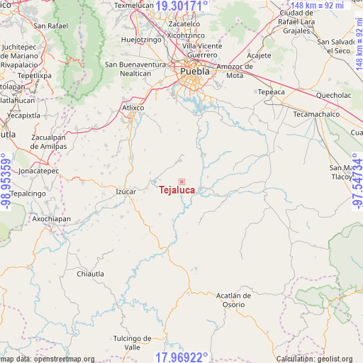
Tejaluca GPS coordinates[2]
18° 38' 12.372" North, 98° 15' 1.656" West
| Map corner | latitude | longitude |
|---|---|---|
| Upper-left | 19.30171°, | -98.95359° |
| Center: | 18.63677°, | -98.25046° |
| Lower-right: | 17.96922°, | -97.54734° |
| Map W x H: | 148.2×148.2 km | = 92.1×92.1mi |
| max Lat: | 32.7° ⇑70.9% North |
| Tejaluca: | 18.63677° |
| min Lat: | ⇓29.1% South 14.53588° |
| min Long | Tejaluca | max Long |
| -117.105° | -98.25046° | -86.73105° |
| W 60.5%⇐ | ⇒39.5% E |
Elevation
Elevation of Tejaluca is 1367 m = 4485 ft, and this is 113.3 m = 372 ft above average elevation for this country.
| Max E: |
3497 m = 11473 ft | 51.3% |
| Tejaluca | 1367 m 4485 ft | |
| Avg. | 1253.7 m = 4113 ft | |
Min E: |
-1 m = -3 ft | 48.7% |
See also: Mexico elevation on elevation.city.
Geographical zone
Tejaluca is located in North Torrid zone (between Equator and Tropic of Cancer). Distance of this Northern Tropic circle is 533.7 km =331.6 mi to North.| Distance of | km | miles | from Tejaluca |
|---|---|---|---|
| North Pole | 7934.8 | 4930.5 | to North |
| Arctic Circle | 5329 | 3311.3 | to North |
| Tropic Cancer | 533.7 | 331.6 | to North |
| Equator | 2072.2 | 1287.6 | to South |


Nearby cities:
15 places around Tejaluca: (largest is in red/bold)
• Ahuatlán
7.1 km =4.4 mi,  185°
185°
• Analco
13.4 km =8.3 mi,  36°
36°
• Ayotla
13.4 km =8.3 mi,  286°
286°
• Coatzingo
8.6 km =5.3 mi,  108°
108°
• Patlanoaya
15.8 km =9.8 mi, 193°
• San José las Bocas
17.8 km =11.1 mi,  258°
258°
• San Juan Epatlán
12.9 km =8 mi,  272°
272°
• San Miguel las Minas
15.9 km =9.9 mi,  213°
213°
• San Pablo Soyatitlanapan
10.8 km =6.7 mi,  79°
79°
• San Pedro Calantla
15.9 km =9.9 mi,  253°
253°
• Santa Ana Necoxtla
14.2 km =8.8 mi, 259°
• Santo Domingo Huehuetlán
14.6 km =9.1 mi, 38°
• Teopantlán
8.5 km =5.3 mi,  350°
350°
• Totoltepec
10.3 km =6.4 mi,  279°
279°
• Xochiltepec
10 km =6.2 mi, 279°
Sources, notices
• [Note1] Compared only with cities in Mexico existing in our database
• [Src1] Map data: © OpenStreetMap contributors (CC-BY-SA)
• [Src2] Other city data from geonames.org with taken over terms of usage.
• [Src3] Geographical zone / Annual Mean Temperature by Robert A. Rohde @ Wikipedia
