Teopantlán geodata
Teopantlán (Puebla) is a seat of a second-order administrative division; located in Mexico in America/Mexico_City (GMT-6) time zone. With population of 2,963 people, there are 3023 cities with bigger population in this country. Compared to other cities in Mexico, 70.1% of cities are located further ↑North; 60.4% of cities are located further ←West and 50.1% of cities have higher elevation than Teopantlán. Note1


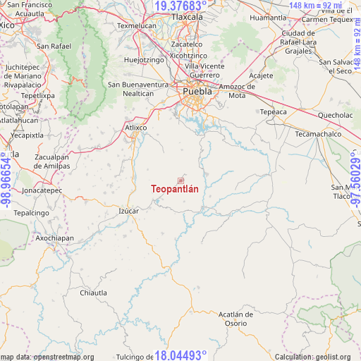
Teopantlán GPS coordinates[2]
18° 42' 43.884" North, 98° 15' 48.276" West
| Map corner | latitude | longitude |
|---|---|---|
| Upper-left | 19.37683°, | -98.96654° |
| Center: | 18.71219°, | -98.26341° |
| Lower-right: | 18.04493°, | -97.56029° |
| Map W x H: | 148.1×148.1 km | = 92×92mi |
| max Lat: | 32.7° ⇑70.1% North |
| Teopantlán: | 18.71219° |
| min Lat: | ⇓29.9% South 14.53588° |
| min Long | Teopantlán | max Long |
| -117.105° | -98.26341° | -86.73105° |
| W 60.4%⇐ | ⇒39.6% E |
Elevation
Elevation of Teopantlán is 1427 m = 4682 ft, and this is 173.3 m = 569 ft above average elevation for this country.
| Max E: |
3497 m = 11473 ft | 50.1% |
| Teopantlán | 1427 m 4682 ft | |
| Avg. | 1253.7 m = 4113 ft | |
Min E: |
-1 m = -3 ft | 49.9% |
See also: Mexico elevation on elevation.city.
Geographical zone
Teopantlán is located in North Torrid zone (between Equator and Tropic of Cancer). Distance of this Northern Tropic circle is 525.3 km =326.4 mi to North.| Distance of | km | miles | from Teopantlán |
|---|---|---|---|
| North Pole | 7926.5 | 4925.3 | to North |
| Arctic Circle | 5320.6 | 3306.1 | to North |
| Tropic Cancer | 525.3 | 326.4 | to North |
| Equator | 2080.6 | 1292.8 | to South |


Nearby cities:
15 places around Teopantlán: (largest is in red/bold)
• Ahuatlán
15.5 km =9.6 mi,  177°
177°
• Analco
9.6 km =6 mi,  75°
75°
• Ayotla
12.4 km =7.7 mi,  247°
247°
• Coatzingo
14.7 km =9.1 mi,  139°
139°
• Jalapexco
14.6 km =9.1 mi,  344°
344°
• San Agustín Ahuahuetla
13.8 km =8.6 mi,  46°
46°
• San Juan Epatlán
13.8 km =8.6 mi,  236°
236°
• San Miguel Atlapulco
11.5 km =7.1 mi,  38°
38°
• San Pablo Soyatitlanapan
13.6 km =8.5 mi,  117°
117°
• Santa María Xoyatla
14.2 km =8.8 mi,  289°
289°
• Santo Domingo Huehuetlán
10.9 km =6.8 mi,  73°
73°
• Tejaluca
8.5 km =5.3 mi,  170°
170°
• Totoltepec
11 km =6.8 mi,  233°
233°
• Xochiltepec
10.9 km =6.8 mi, 231°
• Xoyatla
14.3 km =8.9 mi, 288°
Sources, notices
• [Note1] Compared only with cities in Mexico existing in our database
• [Src1] Map data: © OpenStreetMap contributors (CC-BY-SA)
• [Src2] Other city data from geonames.org with taken over terms of usage.
• [Src3] Geographical zone / Annual Mean Temperature by Robert A. Rohde @ Wikipedia
