San Agustín Ahuahuetla geodata
San Agustín Ahuahuetla (Puebla) is a populated place; located in Mexico in America/Mexico_City (GMT-6) time zone. With population of 861 people, there are 10161 cities with bigger population in this country. Compared to other cities in Mexico, 68.8% of cities are located further ↑North; 61.6% of cities are located further ←West and 53.4% of cities have lower elevation than San Agustín Ahuahuetla. Note1


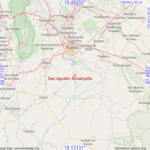
San Agustín Ahuahuetla GPS coordinates[2]
18° 47' 53.628" North, 98° 10' 6.312" West
| Map corner | latitude | longitude |
|---|---|---|
| Upper-left | 19.46252°, | -98.87155° |
| Center: | 18.79823°, | -98.16842° |
| Lower-right: | 18.13131°, | -97.4653° |
| Map W x H: | 148×148 km | = 92×92mi |
| max Lat: | 32.7° ⇑68.8% North |
| San Agustín Ahuahuetla: | 18.79823° |
| min Lat: | ⇓31.2% South 14.53588° |
| min Long | San Agustín Ah | max Long |
| -117.105° | -98.16842° | -86.73105° |
| W 61.6%⇐ | ⇒38.4% E |
Elevation
Elevation of San Agustín Ahuahuetla is 1548 m = 5079 ft, and this is 294.3 m = 966 ft above average elevation for this country.
| Max E: |
3497 m = 11473 ft | 46.6% |
| San Agustín Ahuahuetla | 1548 m 5079 ft | |
| Avg. | 1253.7 m = 4113 ft | |
Min E: |
-1 m = -3 ft | 53.4% |
See also: Mexico elevation on elevation.city.
Geographical zone
San Agustín Ahuahuetla is located in North Torrid zone (between Equator and Tropic of Cancer). Distance of this Northern Tropic circle is 515.8 km =320.5 mi to North.| Distance of | km | miles | from San Agustín Ahuahuetla |
|---|---|---|---|
| North Pole | 7916.9 | 4919.3 | to North |
| Arctic Circle | 5311 | 3300.1 | to North |
| Tropic Cancer | 515.8 | 320.5 | to North |
| Equator | 2090.2 | 1298.8 | to South |


Nearby cities:
15 places around San Agustín Ahuahuetla: (largest is in red/bold)
• Analco
7.2 km =4.5 mi,  185°
185°
• Buenavista Tetela
13.5 km =8.4 mi,  356°
356°
• Jalapexco
14.6 km =9.1 mi,  288°
288°
• La Paz Tlaxcolpan
12.9 km =8 mi,  334°
334°
• Los Ángeles Tetela
10.2 km =6.3 mi,  0°
0°
• San Andrés Azumiatla
14.7 km =9.1 mi,  322°
322°
• San José Texaluca
11.7 km =7.3 mi,  19°
19°
• San José Xacxamayo
7.1 km =4.4 mi, 1°
• San José el Rincón
10.3 km =6.4 mi,  341°
341°
• San Miguel Atlapulco
2.9 km =1.8 mi,  256°
256°
• Santa María Guadalupe Tecola
12.4 km =7.7 mi,  346°
346°
• Santo Domingo Huehuetlán
6.6 km =4.1 mi,  176°
176°
• Teopantlán
13.8 km =8.6 mi,  226°
226°
• Tepetzitzintla
15.9 km =9.9 mi,  140°
140°
• Tzicatlacoyan
13.5 km =8.4 mi,  69°
69°
Sources, notices
• [Note1] Compared only with cities in Mexico existing in our database
• [Src1] Map data: © OpenStreetMap contributors (CC-BY-SA)
• [Src2] Other city data from geonames.org with taken over terms of usage.
• [Src3] Geographical zone / Annual Mean Temperature by Robert A. Rohde @ Wikipedia
