Atecoxco geodata
Atecoxco (Hidalgo) is a populated place; located in Mexico in America/Mexico_City (GMT-6) time zone. With population of 628 people, there are 13781 cities with bigger population in this country. Compared to other cities in Mexico, 68% of cities are located further ↓South; 56.2% of cities are located further ←West and 55.7% of cities have lower elevation than Atecoxco. Note1


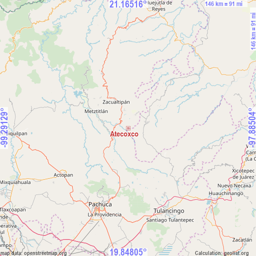
Atecoxco GPS coordinates[2]
20° 30' 28.872" North, 98° 35' 17.376" West
| Map corner | latitude | longitude |
|---|---|---|
| Upper-left | 21.16516°, | -99.29129° |
| Center: | 20.50802°, | -98.58816° |
| Lower-right: | 19.84805°, | -97.88504° |
| Map W x H: | 146.4×146.5 km | = 91×91mi |
| max Lat: | 32.7° ⇑32% North |
| Atecoxco: | 20.50802° |
| min Lat: | ⇓68% South 14.53588° |
| min Long | Atecoxco | max Long |
| -117.105° | -98.58816° | -86.73105° |
| W 56.2%⇐ | ⇒43.8% E |
Elevation
Elevation of Atecoxco is 1609 m = 5279 ft, and this is 355.3 m = 1166 ft above average elevation for this country.
| Max E: |
3497 m = 11473 ft | 44.3% |
| Atecoxco | 1609 m 5279 ft | |
| Avg. | 1253.7 m = 4113 ft | |
Min E: |
-1 m = -3 ft | 55.7% |
See also: Mexico elevation on elevation.city.
Geographical zone
Atecoxco is located in North Torrid zone (between Equator and Tropic of Cancer). Distance of this Northern Tropic circle is 325.6 km =202.3 mi to North.| Distance of | km | miles | from Atecoxco |
|---|---|---|---|
| North Pole | 7726.8 | 4801.2 | to North |
| Arctic Circle | 5120.9 | 3182 | to North |
| Tropic Cancer | 325.6 | 202.3 | to North |
| Equator | 2280.3 | 1416.9 | to South |


Nearby cities:
15 places around Atecoxco: (largest is in red/bold)
• Atopixco
10.6 km =6.6 mi,  349°
349°
• Carbonero Jacales
15.6 km =9.7 mi,  128°
128°
• Carpinteros
10 km =6.2 mi,  30°
30°
• Huayacocotla
11.6 km =7.2 mi,  74°
74°
• La Mojonera
13.5 km =8.4 mi, 345°
• La Selva
10.9 km =6.8 mi,  52°
52°
• Mezquititlán
5.8 km =3.6 mi,  298°
298°
• Palo Bendito
10.8 km =6.7 mi,  121°
121°
• Palo Hueco
15.8 km =9.8 mi, 119°
• Santa Mónica Autempa
13.4 km =8.3 mi,  244°
244°
• Teximalpa
13 km =8.1 mi,  144°
144°
• Tizapán
16 km =9.9 mi,  356°
356°
• Tlahuelompa (San Francisco Tlahuelompa)
15.9 km =9.9 mi,  4°
4°
• Tuzanapa
8 km =5 mi, 3°
• Xoxoteco
3.9 km =2.4 mi,  281°
281°
Sources, notices
• [Note1] Compared only with cities in Mexico existing in our database
• [Src1] Map data: © OpenStreetMap contributors (CC-BY-SA)
• [Src2] Other city data from geonames.org with taken over terms of usage.
• [Src3] Geographical zone / Annual Mean Temperature by Robert A. Rohde @ Wikipedia
