Santa María Jicaltepec geodata
Santa María Jicaltepec (Oaxaca) is a populated place; located in Mexico in America/Mexico_City (GMT-6) time zone. With population of 1,822 people, there are 4778 cities with bigger population in this country. Compared to other cities in Mexico, 95.1% of cities are located further ↑North; 63.1% of cities are located further ←West and 68.2% of cities have higher elevation than Santa María Jicaltepec. Note1


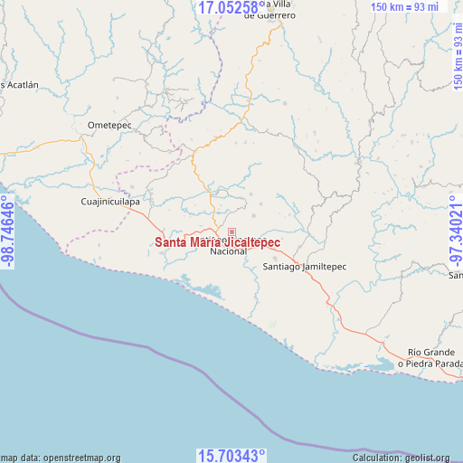
Santa María Jicaltepec GPS coordinates[2]
16° 22' 45.012" North, 98° 2' 35.988" West
| Map corner | latitude | longitude |
|---|---|---|
| Upper-left | 17.05258°, | -98.74646° |
| Center: | 16.37917°, | -98.04333° |
| Lower-right: | 15.70343°, | -97.34021° |
| Map W x H: | 150×150 km | = 93.2×93.2mi |
| max Lat: | 32.7° ⇑95.1% North |
| Santa María Jicaltepec: | 16.37917° |
| min Lat: | ⇓4.9% South 14.53588° |
| min Long | Santa María Ji | max Long |
| -117.105° | -98.04333° | -86.73105° |
| W 63.1%⇐ | ⇒36.9% E |
Elevation
Elevation of Santa María Jicaltepec is 517 m = 1696 ft, and this is 736.7 m = 2417 ft below average elevation for this country.
| Max E: |
3497 m = 11473 ft | 68.2% |
| Avg. | 1253.7 m = 4113 ft | |
| Santa María Jicaltepec | 517 m = 1696 ft | |
Min E: |
-1 m = -3 ft | 31.8% |
See also: Mexico elevation on elevation.city.
Geographical zone
Santa María Jicaltepec is located in North Torrid zone (between Equator and Tropic of Cancer). Distance of this Northern Tropic circle is 784.7 km =487.6 mi to North.| Distance of | km | miles | from Santa María Jicaltepec |
|---|---|---|---|
| North Pole | 8185.9 | 5086.5 | to North |
| Arctic Circle | 5580 | 3467.3 | to North |
| Tropic Cancer | 784.7 | 487.6 | to North |
| Equator | 1821.2 | 1131.6 | to South |


Nearby cities:
15 places around Santa María Jicaltepec: (largest is in red/bold)
• Chuparrosa
9 km =5.6 mi,  356°
356°
• Cruz del Itacuán
10.4 km =6.5 mi,  168°
168°
• Fraccionamiento San Isidro
3 km =1.9 mi,  233°
233°
• Lo de Candela
10.1 km =6.3 mi,  281°
281°
• Mancuernas
7.2 km =4.5 mi, 279°
• Pinotepa Nacional
4.5 km =2.8 mi,  193°
193°
• Pinotepa de Don Luis
8.9 km =5.5 mi,  53°
53°
• Rancho Viejo
9.5 km =5.9 mi,  117°
117°
• San José Yutatuyaa
7.8 km =4.8 mi,  0°
0°
• San Juan Colorado
13.1 km =8.1 mi, 46°
• San Juan Jicayán
11.2 km =7 mi,  17°
17°
• San Miguel Tlacamama
4.5 km =2.8 mi,  332°
332°
• San Pedro Jicayán
8.6 km =5.3 mi, 21°
• Santiago Jicayán
11.6 km =7.2 mi, 17°
• Yutandayoo
9.4 km =5.8 mi,  337°
337°
Sources, notices
• [Note1] Compared only with cities in Mexico existing in our database
• [Src1] Map data: © OpenStreetMap contributors (CC-BY-SA)
• [Src2] Other city data from geonames.org with taken over terms of usage.
• [Src3] Geographical zone / Annual Mean Temperature by Robert A. Rohde @ Wikipedia
