Yutandayoo geodata
Yutandayoo (Oaxaca) is a populated place; located in Mexico in America/Mexico_City (GMT-6) time zone. With population of 796 people, there are 10956 cities with bigger population in this country. Compared to other cities in Mexico, 94.7% of cities are located further ↑North; 62.7% of cities are located further ←West and 74.3% of cities have higher elevation than Yutandayoo. Note1


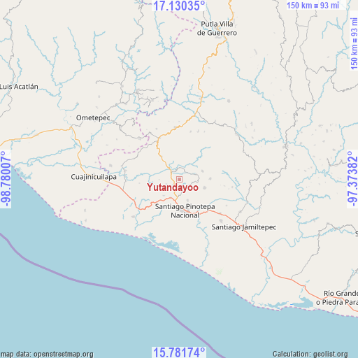
Yutandayoo GPS coordinates[2]
16° 27' 25.992" North, 98° 4' 36.984" West
| Map corner | latitude | longitude |
|---|---|---|
| Upper-left | 17.13035°, | -98.78007° |
| Center: | 16.45722°, | -98.07694° |
| Lower-right: | 15.78174°, | -97.37382° |
| Map W x H: | 150×150 km | = 93.2×93.2mi |
| max Lat: | 32.7° ⇑94.7% North |
| Yutandayoo: | 16.45722° |
| min Lat: | ⇓5.3% South 14.53588° |
| min Long | Yutandayoo | max Long |
| -117.105° | -98.07694° | -86.73105° |
| W 62.7%⇐ | ⇒37.3% E |
Elevation
Elevation of Yutandayoo is 243 m = 797 ft, and this is 1010.7 m = 3316 ft below average elevation for this country.
| Max E: |
3497 m = 11473 ft | 74.3% |
| Avg. | 1253.7 m = 4113 ft | |
| Yutandayoo | 243 m = 797 ft | |
Min E: |
-1 m = -3 ft | 25.7% |
See also: Mexico elevation on elevation.city.
Geographical zone
Yutandayoo is located in North Torrid zone (between Equator and Tropic of Cancer). Distance of this Northern Tropic circle is 776 km =482.2 mi to North.| Distance of | km | miles | from Yutandayoo |
|---|---|---|---|
| North Pole | 8177.2 | 5081.1 | to North |
| Arctic Circle | 5571.3 | 3461.8 | to North |
| Tropic Cancer | 776 | 482.2 | to North |
| Equator | 1829.9 | 1137 | to South |


Nearby cities:
15 places around Yutandayoo: (largest is in red/bold)
• Chuparrosa
3 km =1.9 mi,  84°
84°
• Fraccionamiento San Isidro
10.6 km =6.6 mi,  173°
173°
• Lo de Candela
9.2 km =5.7 mi,  223°
223°
• Mancuernas
8.3 km =5.2 mi,  205°
205°
• Pinotepa de Don Luis
11.2 km =7 mi,  107°
107°
• San Antonio Tepetlapa
9.7 km =6 mi,  7°
7°
• San José Yutatuyaa
3.7 km =2.3 mi,  104°
104°
• San Juan Jicayán
7.2 km =4.5 mi,  73°
73°
• San Miguel Tlacamama
4.9 km =3 mi,  162°
162°
• San Pedro Atoyac
10.4 km =6.5 mi, 69°
• San Pedro Jicayán
6.7 km =4.2 mi, 95°
• San Pedro Tulixtlahuaca
10.2 km =6.3 mi,  26°
26°
• San Sebastián Ixcapa
12.2 km =7.6 mi,  323°
323°
• Santa María Jicaltepec
9.4 km =5.8 mi, 157°
• Santiago Jicayán
7.5 km =4.7 mi, 71°
Sources, notices
• [Note1] Compared only with cities in Mexico existing in our database
• [Src1] Map data: © OpenStreetMap contributors (CC-BY-SA)
• [Src2] Other city data from geonames.org with taken over terms of usage.
• [Src3] Geographical zone / Annual Mean Temperature by Robert A. Rohde @ Wikipedia
