Mancuernas geodata
Mancuernas (Oaxaca) is a populated place; located in Mexico in America/Mexico_City (GMT-6) time zone. With population of 1,825 people, there are 4767 cities with bigger population in this country. Compared to other cities in Mexico, 95% of cities are located further ↑North; 62.4% of cities are located further ←West and 74.2% of cities have higher elevation than Mancuernas. Note1


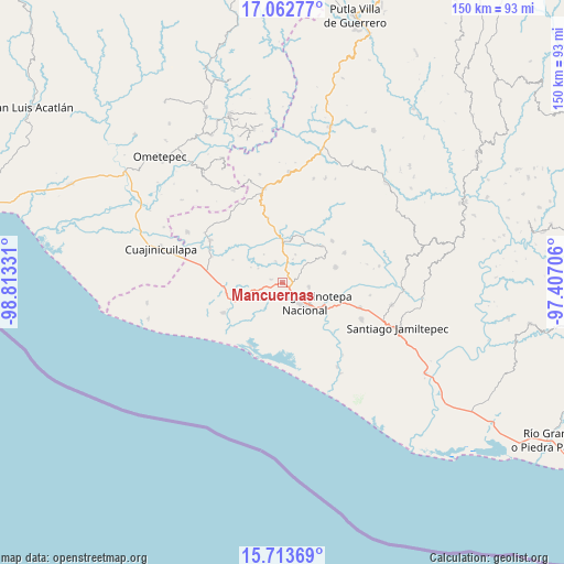
Mancuernas GPS coordinates[2]
16° 23' 21.84" North, 98° 6' 36.648" West
| Map corner | latitude | longitude |
|---|---|---|
| Upper-left | 17.06277°, | -98.81331° |
| Center: | 16.3894°, | -98.11018° |
| Lower-right: | 15.71369°, | -97.40706° |
| Map W x H: | 150×150 km | = 93.2×93.2mi |
| max Lat: | 32.7° ⇑95% North |
| Mancuernas: | 16.3894° |
| min Lat: | ⇓5% South 14.53588° |
| min Long | Mancuernas | max Long |
| -117.105° | -98.11018° | -86.73105° |
| W 62.4%⇐ | ⇒37.6% E |
Elevation
Elevation of Mancuernas is 249 m = 817 ft, and this is 1004.7 m = 3296 ft below average elevation for this country.
| Max E: |
3497 m = 11473 ft | 74.2% |
| Avg. | 1253.7 m = 4113 ft | |
| Mancuernas | 249 m = 817 ft | |
Min E: |
-1 m = -3 ft | 25.8% |
See also: Mexico elevation on elevation.city.
Geographical zone
Mancuernas is located in North Torrid zone (between Equator and Tropic of Cancer). Distance of this Northern Tropic circle is 783.6 km =486.9 mi to North.| Distance of | km | miles | from Mancuernas |
|---|---|---|---|
| North Pole | 8184.7 | 5085.7 | to North |
| Arctic Circle | 5578.8 | 3466.5 | to North |
| Tropic Cancer | 783.6 | 486.9 | to North |
| Equator | 1822.3 | 1132.3 | to South |


Nearby cities:
15 places around Mancuernas: (largest is in red/bold)
• Chuparrosa
10.2 km =6.3 mi,  39°
39°
• Cruz del Itacuán
14.6 km =9.1 mi,  141°
141°
• Fraccionamiento San Isidro
5.6 km =3.5 mi,  122°
122°
• Lagunillas
12.8 km =8 mi,  248°
248°
• Lo de Candela
2.9 km =1.8 mi,  287°
287°
• Pinotepa Nacional
8.2 km =5.1 mi,  131°
131°
• Pinotepa de Don Luis
14.8 km =9.2 mi,  73°
73°
• Rancho Nuevo
14.6 km =9.1 mi, 294°
• San José Yutatuyaa
9.7 km =6 mi,  47°
47°
• San Juan Jicayán
14.2 km =8.8 mi, 47°
• San Miguel Tlacamama
5.8 km =3.6 mi,  60°
60°
• San Pedro Jicayán
12.4 km =7.7 mi, 55°
• Santa María Jicaltepec
7.2 km =4.5 mi,  99°
99°
• Santiago Jicayán
14.6 km =9.1 mi, 47°
• Yutandayoo
8.3 km =5.2 mi,  25°
25°
Sources, notices
• [Note1] Compared only with cities in Mexico existing in our database
• [Src1] Map data: © OpenStreetMap contributors (CC-BY-SA)
• [Src2] Other city data from geonames.org with taken over terms of usage.
• [Src3] Geographical zone / Annual Mean Temperature by Robert A. Rohde @ Wikipedia
