San José Yutatuyaa geodata
San José Yutatuyaa (Oaxaca) is a populated place; located in Mexico in America/Mexico_City (GMT-6) time zone. With population of 551 people, there are 15478 cities with bigger population in this country. Compared to other cities in Mexico, 94.7% of cities are located further ↑North; 63.1% of cities are located further ←West and 73.2% of cities have higher elevation than San José Yutatuyaa. Note1


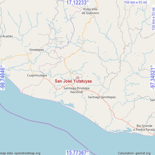
San José Yutatuyaa GPS coordinates[2]
16° 26' 57.012" North, 98° 2' 35.988" West
| Map corner | latitude | longitude |
|---|---|---|
| Upper-left | 17.12233°, | -98.74646° |
| Center: | 16.44917°, | -98.04333° |
| Lower-right: | 15.77367°, | -97.34021° |
| Map W x H: | 150×150 km | = 93.2×93.2mi |
| max Lat: | 32.7° ⇑94.7% North |
| San José Yutatuyaa: | 16.44917° |
| min Lat: | ⇓5.3% South 14.53588° |
| min Long | San José Yutat | max Long |
| -117.105° | -98.04333° | -86.73105° |
| W 63.1%⇐ | ⇒36.9% E |
Elevation
Elevation of San José Yutatuyaa is 281 m = 922 ft, and this is 972.7 m = 3191 ft below average elevation for this country.
| Max E: |
3497 m = 11473 ft | 73.2% |
| Avg. | 1253.7 m = 4113 ft | |
| San José Yutatuyaa | 281 m = 922 ft | |
Min E: |
-1 m = -3 ft | 26.8% |
See also: Mexico elevation on elevation.city.
Geographical zone
San José Yutatuyaa is located in North Torrid zone (between Equator and Tropic of Cancer). Distance of this Northern Tropic circle is 776.9 km =482.7 mi to North.| Distance of | km | miles | from San José Yutatuyaa |
|---|---|---|---|
| North Pole | 8178.1 | 5081.6 | to North |
| Arctic Circle | 5572.2 | 3462.4 | to North |
| Tropic Cancer | 776.9 | 482.7 | to North |
| Equator | 1829 | 1136.5 | to South |


Nearby cities:
15 places around San José Yutatuyaa: (largest is in red/bold)
• Chuparrosa
1.3 km =0.8 mi,  334°
334°
• Fraccionamiento San Isidro
9.9 km =6.2 mi,  194°
194°
• Lo de Candela
11.5 km =7.1 mi,  239°
239°
• Mancuernas
9.7 km =6 mi,  227°
227°
• Pinotepa de Don Luis
7.5 km =4.7 mi,  109°
109°
• San Antonio Tepetlapa
10.8 km =6.7 mi,  347°
347°
• San Juan Colorado
9.6 km =6 mi,  82°
82°
• San Juan Jicayán
4.4 km =2.7 mi,  47°
47°
• San Miguel Tlacamama
4.3 km =2.7 mi,  209°
209°
• San Pedro Atoyac
7.6 km =4.7 mi, 53°
• San Pedro Jicayán
3.1 km =1.9 mi, 84°
• San Pedro Tulixtlahuaca
10.1 km =6.3 mi,  5°
5°
• Santa María Jicaltepec
7.8 km =4.8 mi,  180°
180°
• Santiago Jicayán
4.8 km =3 mi, 46°
• Yutandayoo
3.7 km =2.3 mi,  284°
284°
Sources, notices
• [Note1] Compared only with cities in Mexico existing in our database
• [Src1] Map data: © OpenStreetMap contributors (CC-BY-SA)
• [Src2] Other city data from geonames.org with taken over terms of usage.
• [Src3] Geographical zone / Annual Mean Temperature by Robert A. Rohde @ Wikipedia
