Ahuatempan geodata
Ahuatempan (Puebla) is a populated place; located in Mexico in America/Mexico_City (GMT-6) time zone. With population of 4,105 people, there are 2228 cities with bigger population in this country. Compared to other cities in Mexico, 73.6% of cities are located further ↑North; 63.4% of cities are located further ←West and 64.5% of cities have lower elevation than Ahuatempan. Note1


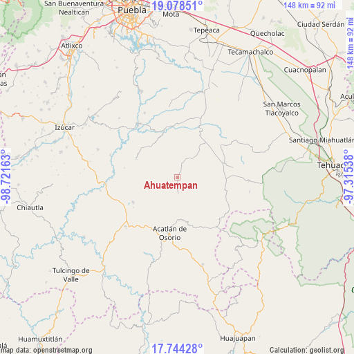
Ahuatempan GPS coordinates[2]
18° 24' 45.684" North, 98° 1' 6.6" West
| Map corner | latitude | longitude |
|---|---|---|
| Upper-left | 19.07851°, | -98.72163° |
| Center: | 18.41269°, | -98.0185° |
| Lower-right: | 17.74428°, | -97.31538° |
| Map W x H: | 148.4×148.4 km | = 92.2×92.2mi |
| max Lat: | 32.7° ⇑73.6% North |
| Ahuatempan: | 18.41269° |
| min Lat: | ⇓26.4% South 14.53588° |
| min Long | Ahuatempan | max Long |
| -117.105° | -98.0185° | -86.73105° |
| W 63.4%⇐ | ⇒36.6% E |
Elevation
Elevation of Ahuatempan is 1813 m = 5948 ft, and this is 559.3 m = 1835 ft above average elevation for this country.
| Max E: |
3497 m = 11473 ft | 35.5% |
| Ahuatempan | 1813 m 5948 ft | |
| Avg. | 1253.7 m = 4113 ft | |
Min E: |
-1 m = -3 ft | 64.5% |
See also: Mexico elevation on elevation.city.
Geographical zone
Ahuatempan is located in North Torrid zone (between Equator and Tropic of Cancer). Distance of this Northern Tropic circle is 558.6 km =347.1 mi to North.| Distance of | km | miles | from Ahuatempan |
|---|---|---|---|
| North Pole | 7959.8 | 4946 | to North |
| Arctic Circle | 5353.9 | 3326.8 | to North |
| Tropic Cancer | 558.6 | 347.1 | to North |
| Equator | 2047.3 | 1272.1 | to South |


Nearby cities:
15 places around Ahuatempan: (largest is in red/bold)
• Agua Santa Ana
13.3 km =8.3 mi,  29°
29°
• Almolonga
9.1 km =5.7 mi,  39°
39°
• Chapultepec (Santo Domingo)
8.7 km =5.4 mi,  19°
19°
• Garzones (Santa Gertrudis)
15 km =9.3 mi,  184°
184°
• Huajoyuca
14 km =8.7 mi, 37°
• Huejonapan
12 km =7.5 mi,  58°
58°
• La Concepción
3.4 km =2.1 mi,  207°
207°
• La Huerta
17.3 km =10.7 mi, 177°
• Mariscala
15.8 km =9.8 mi, 42°
• Moralillo
17 km =10.6 mi, 27°
• San Felipe Otlaltepec
11.7 km =7.3 mi,  96°
96°
• San Francisco Rancho Nuevo
17.6 km =10.9 mi,  194°
194°
• San Juan Nepomuceno
2.2 km =1.4 mi, 181°
• San Vicente Boquerón
15.3 km =9.5 mi, 194°
• Tianguistengo
17.6 km =10.9 mi, 179°
Sources, notices
• [Note1] Compared only with cities in Mexico existing in our database
• [Src1] Map data: © OpenStreetMap contributors (CC-BY-SA)
• [Src2] Other city data from geonames.org with taken over terms of usage.
• [Src3] Geographical zone / Annual Mean Temperature by Robert A. Rohde @ Wikipedia
