San Vicente Boquerón geodata
San Vicente Boquerón (Puebla) is a populated place; located in Mexico in America/Mexico_City (GMT-6) time zone. With population of 2,661 people, there are 3321 cities with bigger population in this country. Compared to other cities in Mexico, 75.2% of cities are located further ↑North; 62.9% of cities are located further ←West and 53.1% of cities have higher elevation than San Vicente Boquerón. Note1


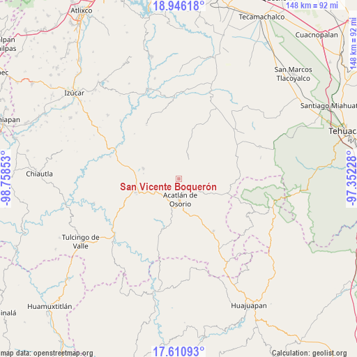
San Vicente Boquerón GPS coordinates[2]
18° 16' 47.424" North, 98° 3' 19.44" West
| Map corner | latitude | longitude |
|---|---|---|
| Upper-left | 18.94618°, | -98.75853° |
| Center: | 18.27984°, | -98.0554° |
| Lower-right: | 17.61093°, | -97.35228° |
| Map W x H: | 148.5×148.5 km | = 92.3×92.3mi |
| max Lat: | 32.7° ⇑75.2% North |
| San Vicente Boquerón: | 18.27984° |
| min Lat: | ⇓24.8% South 14.53588° |
| min Long | San Vicente Boq | max Long |
| -117.105° | -98.0554° | -86.73105° |
| W 62.9%⇐ | ⇒37.1% E |
Elevation
Elevation of San Vicente Boquerón is 1286 m = 4219 ft, and this is 32.3 m = 106 ft above average elevation for this country.
| Max E: |
3497 m = 11473 ft | 53.1% |
| San Vicente Boquerón | 1286 m 4219 ft | |
| Avg. | 1253.7 m = 4113 ft | |
Min E: |
-1 m = -3 ft | 46.9% |
See also: Mexico elevation on elevation.city.
Geographical zone
San Vicente Boquerón is located in North Torrid zone (between Equator and Tropic of Cancer). Distance of this Northern Tropic circle is 573.4 km =356.3 mi to North.| Distance of | km | miles | from San Vicente Boquerón |
|---|---|---|---|
| North Pole | 7974.5 | 4955.1 | to North |
| Arctic Circle | 5368.6 | 3335.9 | to North |
| Tropic Cancer | 573.4 | 356.3 | to North |
| Equator | 2032.5 | 1262.9 | to South |


Nearby cities:
15 places around San Vicente Boquerón: (largest is in red/bold)
• Acatlán de Osorio
8.6 km =5.3 mi,  175°
175°
• Ahuatempan
15.3 km =9.5 mi,  14°
14°
• Amatitlán de Azueta
11.7 km =7.3 mi,  190°
190°
• Garzones (Santa Gertrudis)
2.7 km =1.7 mi,  93°
93°
• Hermenegildo Galeana
5.6 km =3.5 mi,  242°
242°
• La Concepción
12 km =7.5 mi, 11°
• La Huerta
5.2 km =3.2 mi,  119°
119°
• La Noria Hidalgo
15.2 km =9.4 mi,  286°
286°
• Las Nieves
10.7 km =6.6 mi,  174°
174°
• San Bernardo
9.1 km =5.7 mi,  214°
214°
• San Francisco Rancho Nuevo
2.3 km =1.4 mi, 194°
• San Juan Nepomuceno
13.1 km =8.1 mi,  17°
17°
• Tetelcingo
5.4 km =3.4 mi,  146°
146°
• Tianguistengo
5 km =3.1 mi, 124°
• Xayacatlán de Bravo
9.7 km =6 mi, 119°
Sources, notices
• [Note1] Compared only with cities in Mexico existing in our database
• [Src1] Map data: © OpenStreetMap contributors (CC-BY-SA)
• [Src2] Other city data from geonames.org with taken over terms of usage.
• [Src3] Geographical zone / Annual Mean Temperature by Robert A. Rohde @ Wikipedia
