San Antonio Portezuelo geodata
San Antonio Portezuelo (Puebla) is a populated place; located in Mexico in America/Mexico_City (GMT-6) time zone. With population of 3,515 people, there are 2597 cities with bigger population in this country. Compared to other cities in Mexico, 64.7% of cities are located further ↑North; 67.1% of cities are located further ←West and 81.5% of cities have lower elevation than San Antonio Portezuelo. Note1


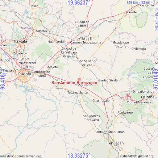
San Antonio Portezuelo GPS coordinates[2]
18° 59' 56.004" North, 97° 42' 48.996" West
| Map corner | latitude | longitude |
|---|---|---|
| Upper-left | 19.66237°, | -98.41674° |
| Center: | 18.99889°, | -97.71361° |
| Lower-right: | 18.33275°, | -97.01049° |
| Map W x H: | 147.8×147.8 km | = 91.8×91.8mi |
| max Lat: | 32.7° ⇑64.7% North |
| San Antonio Portezuelo: | 18.99889° |
| min Lat: | ⇓35.3% South 14.53588° |
| min Long | San Antonio Por | max Long |
| -117.105° | -97.71361° | -86.73105° |
| W 67.1%⇐ | ⇒32.9% E |
Elevation
Elevation of San Antonio Portezuelo is 2175 m = 7136 ft, and this is 921.3 m = 3023 ft above average elevation for this country.
| Max E: |
3497 m = 11473 ft | 18.5% |
| San Antonio Portezuelo | 2175 m 7136 ft | |
| Avg. | 1253.7 m = 4113 ft | |
Min E: |
-1 m = -3 ft | 81.5% |
See also: Mexico elevation on elevation.city.
Geographical zone
San Antonio Portezuelo is located in North Torrid zone (between Equator and Tropic of Cancer). Distance of this Northern Tropic circle is 493.4 km =306.6 mi to North.| Distance of | km | miles | from San Antonio Portezuelo |
|---|---|---|---|
| North Pole | 7894.6 | 4905.5 | to North |
| Arctic Circle | 5288.7 | 3286.2 | to North |
| Tropic Cancer | 493.4 | 306.6 | to North |
| Equator | 2112.5 | 1312.6 | to South |


Nearby cities:
15 places around San Antonio Portezuelo: (largest is in red/bold)
• Acatzingo
7.6 km =4.7 mi,  255°
255°
• Actipan de Morelos
10 km =6.2 mi,  244°
244°
• Candelaria Portezuelo
5 km =3.1 mi,  15°
15°
• Francisco I. Madero
8.3 km =5.2 mi,  157°
157°
• La Compañia
3.3 km =2.1 mi,  197°
197°
• Lomas de Romero
9.4 km =5.8 mi,  182°
182°
• Lomas de Santa Cruz
8.5 km =5.3 mi,  191°
191°
• Progreso de Juárez
6 km =3.7 mi,  226°
226°
• Quecholac
7.6 km =4.7 mi,  130°
130°
• San Pablo de las Tunas
0.6 km =0.4 mi, 132°
• San Sebastián Teteles
8.9 km =5.5 mi,  294°
294°
• San Sebastián Villanueva
6.9 km =4.3 mi,  354°
354°
• San Simón
3.5 km =2.2 mi, 177°
• Santiago Tenango
7.3 km =4.5 mi,  86°
86°
• Tlaixpan
10 km =6.2 mi, 195°
Sources, notices
• [Note1] Compared only with cities in Mexico existing in our database
• [Src1] Map data: © OpenStreetMap contributors (CC-BY-SA)
• [Src2] Other city data from geonames.org with taken over terms of usage.
• [Src3] Geographical zone / Annual Mean Temperature by Robert A. Rohde @ Wikipedia
