San Rafael Zaragoza geodata
San Rafael Zaragoza (Morelos) is a populated place; located in Mexico in America/Mexico_City (GMT-6) time zone. With population of 1,226 people, there are 7077 cities with bigger population in this country. Compared to other cities in Mexico, 70.9% of cities are located further ↑North; 50.1% of cities are located further ←West and 59.1% of cities have higher elevation than San Rafael Zaragoza. Note1


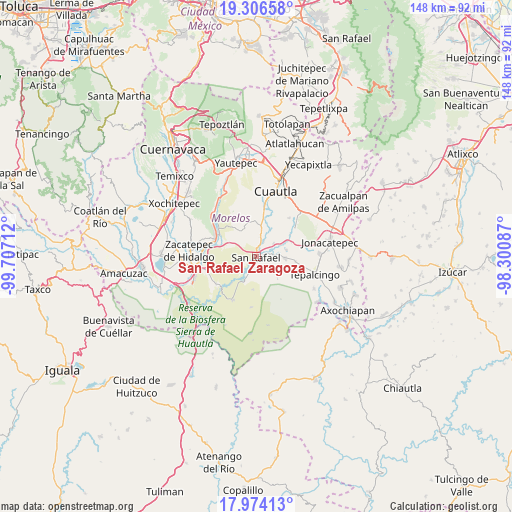
San Rafael Zaragoza GPS coordinates[2]
18° 38' 29.976" North, 99° 0' 14.364" West
| Map corner | latitude | longitude |
|---|---|---|
| Upper-left | 19.30658°, | -99.70712° |
| Center: | 18.64166°, | -99.00399° |
| Lower-right: | 17.97413°, | -98.30087° |
| Map W x H: | 148.2×148.2 km | = 92.1×92.1mi |
| max Lat: | 32.7° ⇑70.9% North |
| San Rafael Zaragoza: | 18.64166° |
| min Lat: | ⇓29.1% South 14.53588° |
| min Long | San Rafael Zara | max Long |
| -117.105° | -99.00399° | -86.73105° |
| W 50.1%⇐ | ⇒49.9% E |
Elevation
Elevation of San Rafael Zaragoza is 1047 m = 3435 ft, and this is 206.7 m = 678 ft below average elevation for this country.
| Max E: |
3497 m = 11473 ft | 59.1% |
| Avg. | 1253.7 m = 4113 ft | |
| San Rafael Zaragoza | 1047 m = 3435 ft | |
Min E: |
-1 m = -3 ft | 40.9% |
See also: Mexico elevation on elevation.city.
Geographical zone
San Rafael Zaragoza is located in North Torrid zone (between Equator and Tropic of Cancer). Distance of this Northern Tropic circle is 533.2 km =331.3 mi to North.| Distance of | km | miles | from San Rafael Zaragoza |
|---|---|---|---|
| North Pole | 7934.3 | 4930.1 | to North |
| Arctic Circle | 5328.4 | 3310.9 | to North |
| Tropic Cancer | 533.2 | 331.3 | to North |
| Equator | 2072.8 | 1288 | to South |


Nearby cities:
15 places around San Rafael Zaragoza: (largest is in red/bold)
• Abelardo L. Rodríguez
10.8 km =6.7 mi,  10°
10°
• Chinameca
2.3 km =1.4 mi,  162°
162°
• Colonia Ejidal Rafael Merino
11.5 km =7.1 mi, 10°
• El Salitre
6.2 km =3.9 mi,  51°
51°
• El Vergel
6.6 km =4.1 mi,  209°
209°
• Huitchila
8.3 km =5.2 mi,  92°
92°
• Lorenzo Vázquez (Santa Cruz)
10.5 km =6.5 mi,  223°
223°
• Moyotepec
8.9 km =5.5 mi, 6°
• Olintepec
11.1 km =6.9 mi, 9°
• San Juan Ahuehueyo
11.1 km =6.9 mi,  42°
42°
• San Pablo Hidalgo
7.8 km =4.8 mi, 212°
• San Vicente de Juárez
5 km =3.1 mi,  23°
23°
• Tenextepango
10.9 km =6.8 mi,  26°
26°
• Valle de Morelos
10.9 km =6.8 mi, 20°
• Zacapalco
4.7 km =2.9 mi, 93°
Sources, notices
• [Note1] Compared only with cities in Mexico existing in our database
• [Src1] Map data: © OpenStreetMap contributors (CC-BY-SA)
• [Src2] Other city data from geonames.org with taken over terms of usage.
• [Src3] Geographical zone / Annual Mean Temperature by Robert A. Rohde @ Wikipedia
