El Vergel geodata
El Vergel (Morelos) is a populated place; located in Mexico in America/Mexico_City (GMT-6) time zone. With population of 827 people, there are 10571 cities with bigger population in this country. Compared to other cities in Mexico, 71.6% of cities are located further ↑North; 50.3% of cities are located further →East and 61.1% of cities have higher elevation than El Vergel. Note1


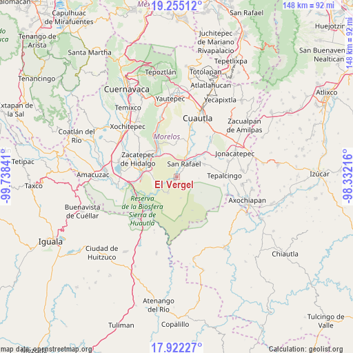
El Vergel GPS coordinates[2]
18° 35' 24" North, 99° 2' 7.008" West
| Map corner | latitude | longitude |
|---|---|---|
| Upper-left | 19.25512°, | -99.73841° |
| Center: | 18.59°, | -99.03528° |
| Lower-right: | 17.92227°, | -98.33216° |
| Map W x H: | 148.2×148.2 km | = 92.1×92.1mi |
| max Lat: | 32.7° ⇑71.6% North |
| El Vergel: | 18.59° |
| min Lat: | ⇓28.4% South 14.53588° |
| min Long | El Vergel | max Long |
| -117.105° | -99.03528° | -86.73105° |
| W 49.7%⇐ | ⇒50.3% E |
Elevation
Elevation of El Vergel is 934 m = 3064 ft, and this is 319.7 m = 1049 ft below average elevation for this country.
| Max E: |
3497 m = 11473 ft | 61.1% |
| Avg. | 1253.7 m = 4113 ft | |
| El Vergel | 934 m = 3064 ft | |
Min E: |
-1 m = -3 ft | 38.9% |
See also: Mexico elevation on elevation.city.
Geographical zone
El Vergel is located in North Torrid zone (between Equator and Tropic of Cancer). Distance of this Northern Tropic circle is 538.9 km =334.9 mi to North.| Distance of | km | miles | from El Vergel |
|---|---|---|---|
| North Pole | 7940 | 4933.7 | to North |
| Arctic Circle | 5334.2 | 3314.5 | to North |
| Tropic Cancer | 538.9 | 334.9 | to North |
| Equator | 2067 | 1284.4 | to South |


Nearby cities:
15 places around El Vergel: (largest is in red/bold)
• Chinameca
5.3 km =3.3 mi,  47°
47°
• Colonia 3 de Mayo (El Tepiolol)
13.2 km =8.2 mi,  291°
291°
• El Salitre
12.5 km =7.8 mi,  40°
40°
• Huitchila
12.8 km =8 mi,  64°
64°
• La Mezquitera
7.5 km =4.7 mi,  245°
245°
• Lorenzo Vázquez (Santa Cruz)
4.4 km =2.7 mi, 245°
• Palo Grande
11.8 km =7.3 mi,  272°
272°
• Quilamula
9 km =5.6 mi,  168°
168°
• San Pablo Hidalgo
1.2 km =0.7 mi,  226°
226°
• San Rafael Zaragoza
6.6 km =4.1 mi,  29°
29°
• San Vicente de Juárez
11.7 km =7.3 mi, 26°
• Temilpa Viejo
14.3 km =8.9 mi,  329°
329°
• Tlaltizapán
13.9 km =8.6 mi,  320°
320°
• Valle de Vázquez
7.7 km =4.8 mi,  207°
207°
• Zacapalco
9.7 km =6 mi, 55°
Sources, notices
• [Note1] Compared only with cities in Mexico existing in our database
• [Src1] Map data: © OpenStreetMap contributors (CC-BY-SA)
• [Src2] Other city data from geonames.org with taken over terms of usage.
• [Src3] Geographical zone / Annual Mean Temperature by Robert A. Rohde @ Wikipedia
