Bustamante geodata
Bustamante (Tamaulipas) is a seat of a second-order administrative division; located in Mexico in America/Monterrey (GMT-6) time zone. With population of 1,392 people, there are 6215 cities with bigger population in this country. Compared to other cities in Mexico, 88.9% of cities are located further ↓South; 60.9% of cities are located further →East and 58.2% of cities have lower elevation than Bustamante. Note1


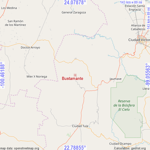
Bustamante GPS coordinates[2]
23° 26' 6.864" North, 99° 45' 31.5" West
| Map corner | latitude | longitude |
|---|---|---|
| Upper-left | 24.07878°, | -100.46188° |
| Center: | 23.43524°, | -99.75875° |
| Lower-right: | 22.78855°, | -99.05563° |
| Map W x H: | 143.5×143.5 km | = 89.2×89.2mi |
| max Lat: | 32.7° ⇑11.1% North |
| Bustamante: | 23.43524° |
| min Lat: | ⇓88.9% South 14.53588° |
| min Long | Bustamante | max Long |
| -117.105° | -99.75875° | -86.73105° |
| W 39.1%⇐ | ⇒60.9% E |
Elevation
Elevation of Bustamante is 1694 m = 5558 ft, and this is 440.3 m = 1445 ft above average elevation for this country.
| Max E: |
3497 m = 11473 ft | 41.8% |
| Bustamante | 1694 m 5558 ft | |
| Avg. | 1253.7 m = 4113 ft | |
Min E: |
-1 m = -3 ft | 58.2% |
See also: Mexico elevation on elevation.city.
Geographical zone
Bustamante is located in North Torrid zone (between Equator and Tropic of Cancer). Distance of this Northern Tropic circle is 0.2 km =0.1 mi to North.| Distance of | km | miles | from Bustamante |
|---|---|---|---|
| North Pole | 7401.3 | 4599 | to North |
| Arctic Circle | 4795.4 | 2979.7 | to North |
| Tropic Cancer | 0.2 | 0.1 | to North |
| Equator | 2605.8 | 1619.2 | to South |


Nearby cities:
15 places around Bustamante: (largest is in red/bold)
• Calabacillas
24.2 km =15 mi,  174°
174°
• El Aguacate
11.6 km =7.2 mi,  182°
182°
• Felipe Ángeles
5.2 km =3.2 mi, 176°
• Jaumave
38.7 km =24 mi,  94°
94°
• Juamave
38.7 km =24 mi, 94°
• La Cardona
22.9 km =14.2 mi,  261°
261°
• La Peña
15.4 km =9.6 mi,  27°
27°
• Mier y Noriega
36.6 km =22.7 mi,  267°
267°
• Miquihuana
15.6 km =9.7 mi,  1°
1°
• Palmillas
26 km =16.2 mi,  124°
124°
• Salitrillo
31 km =19.3 mi,  193°
193°
• San José del Llano
21.1 km =13.1 mi,  301°
301°
• San Juanito
35.2 km =21.9 mi, 86°
• San Rafael
34.7 km =21.6 mi, 185°
• Álvaro Obregón
29.8 km =18.5 mi, 167°
Sources, notices
• [Note1] Compared only with cities in Mexico existing in our database
• [Src1] Map data: © OpenStreetMap contributors (CC-BY-SA)
• [Src2] Other city data from geonames.org with taken over terms of usage.
• [Src3] Geographical zone / Annual Mean Temperature by Robert A. Rohde @ Wikipedia
