San Ignacio geodata
San Ignacio (San Luis Potosí) is a populated place; located in Mexico in America/Mexico_City (GMT-6) time zone. With population of 802 people, there are 10884 cities with bigger population in this country. Compared to other cities in Mexico, 88.4% of cities are located further ↓South; 66.2% of cities are located further →East and 54.4% of cities have higher elevation than San Ignacio. Note1


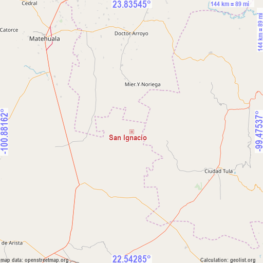
San Ignacio GPS coordinates[2]
23° 11' 26.556" North, 100° 10' 42.564" West
| Map corner | latitude | longitude |
|---|---|---|
| Upper-left | 23.83545°, | -100.88162° |
| Center: | 23.19071°, | -100.17849° |
| Lower-right: | 22.54285°, | -99.47537° |
| Map W x H: | 143.7×143.7 km | = 89.3×89.3mi |
| max Lat: | 32.7° ⇑11.6% North |
| San Ignacio: | 23.19071° |
| min Lat: | ⇓88.4% South 14.53588° |
| min Long | San Ignacio | max Long |
| -117.105° | -100.17849° | -86.73105° |
| W 33.8%⇐ | ⇒66.2% E |
Elevation
Elevation of San Ignacio is 1224 m = 4016 ft, and this is 29.7 m = 97 ft below average elevation for this country.
| Max E: |
3497 m = 11473 ft | 54.4% |
| Avg. | 1253.7 m = 4113 ft | |
| San Ignacio | 1224 m = 4016 ft | |
Min E: |
-1 m = -3 ft | 45.6% |
See also: Mexico elevation on elevation.city.
Geographical zone
San Ignacio is located in North Torrid zone (between Equator and Tropic of Cancer). Distance of this Northern Tropic circle is 27.4 km =17 mi to North.| Distance of | km | miles | from San Ignacio |
|---|---|---|---|
| North Pole | 7428.5 | 4615.9 | to North |
| Arctic Circle | 4822.6 | 2996.6 | to North |
| Tropic Cancer | 27.4 | 17 | to North |
| Equator | 2578.6 | 1602.3 | to South |


Nearby cities:
15 places around San Ignacio: (largest is in red/bold)
• Cerros Blancos
16.4 km =10.2 mi,  356°
356°
• El Huisache
37.8 km =23.5 mi,  216°
216°
• Entronque de Matehuala (El Huizache)
41.2 km =25.6 mi, 224°
• La Cardona
31.1 km =19.3 mi,  40°
40°
• La Moreña
24.3 km =15.1 mi,  323°
323°
• La Pólvora
33.3 km =20.7 mi,  209°
209°
• La Ventana
21.9 km =13.6 mi,  203°
203°
• Las Palomas (Lajillas)
39.5 km =24.5 mi, 359°
• Lázaro Cárdenas
27.6 km =17.1 mi,  152°
152°
• Mier y Noriega
26.5 km =16.5 mi,  13°
13°
• Norias del Refugio
35.9 km =22.3 mi,  236°
236°
• Salitrillo
36 km =22.4 mi,  94°
94°
• San Rafael
40 km =24.9 mi,  100°
100°
• Santa Ana de Nahola
38.4 km =23.9 mi,  125°
125°
• Santo Domingo
37.7 km =23.4 mi, 196°
Sources, notices
• [Note1] Compared only with cities in Mexico existing in our database
• [Src1] Map data: © OpenStreetMap contributors (CC-BY-SA)
• [Src2] Other city data from geonames.org with taken over terms of usage.
• [Src3] Geographical zone / Annual Mean Temperature by Robert A. Rohde @ Wikipedia
