Atla geodata
Atla (Puebla) is a populated place; located in Mexico in America/Mexico_City (GMT-6) time zone. With population of 2,172 people, there are 4050 cities with bigger population in this country. Compared to other cities in Mexico, 63% of cities are located further ↓South; 62.2% of cities are located further ←West and 56.8% of cities have higher elevation than Atla. Note1


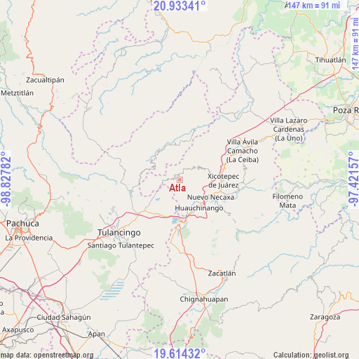
Atla GPS coordinates[2]
20° 16' 30.972" North, 98° 7' 28.884" West
| Map corner | latitude | longitude |
|---|---|---|
| Upper-left | 20.93341°, | -98.82782° |
| Center: | 20.27527°, | -98.12469° |
| Lower-right: | 19.61432°, | -97.42157° |
| Map W x H: | 146.7×146.7 km | = 91.2×91.2mi |
| max Lat: | 32.7° ⇑37% North |
| Atla: | 20.27527° |
| min Lat: | ⇓63% South 14.53588° |
| min Long | Atla | max Long |
| -117.105° | -98.12469° | -86.73105° |
| W 62.2%⇐ | ⇒37.8% E |
Elevation
Elevation of Atla is 1128 m = 3701 ft, and this is 125.7 m = 412 ft below average elevation for this country.
| Max E: |
3497 m = 11473 ft | 56.8% |
| Avg. | 1253.7 m = 4113 ft | |
| Atla | 1128 m = 3701 ft | |
Min E: |
-1 m = -3 ft | 43.2% |
See also: Mexico elevation on elevation.city.
Geographical zone
Atla is located in North Torrid zone (between Equator and Tropic of Cancer). Distance of this Northern Tropic circle is 351.5 km =218.4 mi to North.| Distance of | km | miles | from Atla |
|---|---|---|---|
| North Pole | 7752.7 | 4817.3 | to North |
| Arctic Circle | 5146.8 | 3198.1 | to North |
| Tropic Cancer | 351.5 | 218.4 | to North |
| Equator | 2254.4 | 1400.8 | to South |


Nearby cities:
15 places around Atla: (largest is in red/bold)
• Acalapa
5.5 km =3.4 mi,  37°
37°
• Atlantongo
1.3 km =0.8 mi,  151°
151°
• Copila
4.4 km =2.7 mi,  93°
93°
• Cuauneutla de la Paz
4.9 km =3 mi,  27°
27°
• Cueyatla
4.7 km =2.9 mi,  66°
66°
• Icxotitla
4.4 km =2.7 mi, 145°
• Naupan
5.2 km =3.2 mi,  161°
161°
• Paciotla
3 km =1.9 mi,  321°
321°
• Pahuatlán de Valle
2.7 km =1.7 mi,  276°
276°
• San Pablito
4.8 km =3 mi,  306°
306°
• Tlalcruz de Libres
3.5 km =2.2 mi,  22°
22°
• Tlaxpanaloya
5.5 km =3.4 mi,  175°
175°
• Xochimilco
4.7 km =2.9 mi, 319°
• Xolotla
2.1 km =1.3 mi,  204°
204°
• Zoyatla de Guerrero
2.9 km =1.8 mi,  350°
350°
Sources, notices
• [Note1] Compared only with cities in Mexico existing in our database
• [Src1] Map data: © OpenStreetMap contributors (CC-BY-SA)
• [Src2] Other city data from geonames.org with taken over terms of usage.
• [Src3] Geographical zone / Annual Mean Temperature by Robert A. Rohde @ Wikipedia
