San Miguel Tilquiapam geodata
San Miguel Tilquiapam (Oaxaca) is a seat of a second-order administrative division; located in Mexico in America/Mexico_City (GMT-6) time zone. With population of 3,153 people, there are 2865 cities with bigger population in this country. Compared to other cities in Mexico, 92% of cities are located further ↑North; 79.3% of cities are located further ←West and 57.6% of cities have lower elevation than San Miguel Tilquiapam. Note1


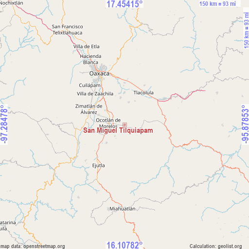
San Miguel Tilquiapam GPS coordinates[2]
16° 46' 55.848" North, 96° 34' 53.94" West
| Map corner | latitude | longitude |
|---|---|---|
| Upper-left | 17.45415°, | -97.28478° |
| Center: | 16.78218°, | -96.58165° |
| Lower-right: | 16.10782°, | -95.87853° |
| Map W x H: | 149.7×149.7 km | = 93×93mi |
| max Lat: | 32.7° ⇑92% North |
| San Miguel Tilquiapam: | 16.78218° |
| min Lat: | ⇓8% South 14.53588° |
| min Long | San Miguel Tilq | max Long |
| -117.105° | -96.58165° | -86.73105° |
| W 79.3%⇐ | ⇒20.7% E |
Elevation
Elevation of San Miguel Tilquiapam is 1679 m = 5509 ft, and this is 425.3 m = 1395 ft above average elevation for this country.
| Max E: |
3497 m = 11473 ft | 42.4% |
| San Miguel Tilquiapam | 1679 m 5509 ft | |
| Avg. | 1253.7 m = 4113 ft | |
Min E: |
-1 m = -3 ft | 57.6% |
See also: Mexico elevation on elevation.city.
Geographical zone
San Miguel Tilquiapam is located in North Torrid zone (between Equator and Tropic of Cancer). Distance of this Northern Tropic circle is 739.9 km =459.8 mi to North.| Distance of | km | miles | from San Miguel Tilquiapam |
|---|---|---|---|
| North Pole | 8141.1 | 5058.6 | to North |
| Arctic Circle | 5535.2 | 3439.4 | to North |
| Tropic Cancer | 739.9 | 459.8 | to North |
| Equator | 1866 | 1159.5 | to South |


Nearby cities:
15 places around San Miguel Tilquiapam: (largest is in red/bold)
• Ocotlán de Morelos
9.9 km =6.2 mi,  275°
275°
• Praxedis de Guerrero
9.3 km =5.8 mi,  221°
221°
• San Antonino Castillo Velasco
11 km =6.8 mi, 281°
• San Baltazar Chichicapam
10.1 km =6.3 mi,  103°
103°
• San Dionisio Ocotlán
11.2 km =7 mi,  249°
249°
• San Jacinto Chilateca
12.7 km =7.9 mi,  300°
300°
• San Jerónimo Taviche
7.6 km =4.7 mi,  189°
189°
• San José la Garzona
12.8 km =8 mi,  208°
208°
• San Juan Chilateca
10.7 km =6.6 mi, 299°
• Santa Catarina Minas
3.6 km =2.2 mi,  265°
265°
• Santa Cecilia Jalieza
11.9 km =7.4 mi,  342°
342°
• Santa Lucía Ocotlán
11.5 km =7.1 mi,  244°
244°
• Santo Domingo Jalieza
10.8 km =6.7 mi,  332°
332°
• Santo Tomás Jalieza
11.7 km =7.3 mi,  306°
306°
• Yaxe
13.3 km =8.3 mi,  118°
118°
Sources, notices
• [Note1] Compared only with cities in Mexico existing in our database
• [Src1] Map data: © OpenStreetMap contributors (CC-BY-SA)
• [Src2] Other city data from geonames.org with taken over terms of usage.
• [Src3] Geographical zone / Annual Mean Temperature by Robert A. Rohde @ Wikipedia
