San Miguel Canoa geodata
San Miguel Canoa (Puebla) is a populated place; located in Mexico in America/Mexico_City (GMT-6) time zone. With population of 14,863 people, there are 652 cities with bigger population in this country. Compared to other cities in Mexico, 62.1% of cities are located further ↑North; 62.5% of cities are located further ←West and 95% of cities have lower elevation than San Miguel Canoa. Note1


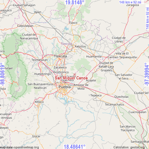
San Miguel Canoa GPS coordinates[2]
19° 9' 6.984" North, 98° 6' 11.016" West
| Map corner | latitude | longitude |
|---|---|---|
| Upper-left | 19.8148°, | -98.80619° |
| Center: | 19.15194°, | -98.10306° |
| Lower-right: | 18.48641°, | -97.39994° |
| Map W x H: | 147.7×147.7 km | = 91.8×91.8mi |
| max Lat: | 32.7° ⇑62.1% North |
| San Miguel Canoa: | 19.15194° |
| min Lat: | ⇓37.9% South 14.53588° |
| min Long | San Miguel Cano | max Long |
| -117.105° | -98.10306° | -86.73105° |
| W 62.5%⇐ | ⇒37.5% E |
Elevation
Elevation of San Miguel Canoa is 2596 m = 8517 ft, and this is 1342.3 m = 4404 ft above average elevation for this country.
| Max E: |
3497 m = 11473 ft | 5% |
| San Miguel Canoa | 2596 m 8517 ft | |
| Avg. | 1253.7 m = 4113 ft | |
Min E: |
-1 m = -3 ft | 95% |
See also: Mexico elevation on elevation.city.
Geographical zone
San Miguel Canoa is located in North Torrid zone (between Equator and Tropic of Cancer). Distance of this Northern Tropic circle is 476.4 km =296 mi to North.| Distance of | km | miles | from San Miguel Canoa |
|---|---|---|---|
| North Pole | 7877.6 | 4894.9 | to North |
| Arctic Circle | 5271.7 | 3275.7 | to North |
| Tropic Cancer | 476.4 | 296 | to North |
| Equator | 2129.5 | 1323.2 | to South |


Nearby cities:
15 places around San Miguel Canoa: (largest is in red/bold)
• 6 de Junio
6.6 km =4.1 mi,  224°
224°
• Ayometitla
11.3 km =7 mi,  303°
303°
• Concepción Capulac (La Ex-Hacienda)
7.7 km =4.8 mi,  145°
145°
• La Resurrección
6.2 km =3.9 mi,  207°
207°
• Mazatecochco
9.3 km =5.8 mi,  288°
288°
• Papalotla
10.8 km =6.7 mi,  279°
279°
• Primero de Mayo
7.8 km =4.8 mi,  175°
175°
• San Isidro Buen Suceso
0.4 km =0.2 mi,  329°
329°
• San Jacinto
11.4 km =7.1 mi,  160°
160°
• San Miguel Espejo
7.4 km =4.6 mi, 148°
• San Sebastián de Aparicio
8.1 km =5 mi,  228°
228°
• Santa María Xonacatepec
6.9 km =4.3 mi, 180°
• Signoret
10.6 km =6.6 mi,  173°
173°
• Tenancingo
10.3 km =6.4 mi,  267°
267°
• Villa Vicente Guerrero
7.4 km =4.6 mi,  242°
242°
Sources, notices
• [Note1] Compared only with cities in Mexico existing in our database
• [Src1] Map data: © OpenStreetMap contributors (CC-BY-SA)
• [Src2] Other city data from geonames.org with taken over terms of usage.
• [Src3] Geographical zone / Annual Mean Temperature by Robert A. Rohde @ Wikipedia
