Villa Vicente Guerrero geodata
Villa Vicente Guerrero (Tlaxcala) is a seat of a second-order administrative division; located in Mexico in America/Mexico_City (GMT-6) time zone. With population of 60,001 people, there are 194 cities with bigger population in this country. Compared to other cities in Mexico, 62.7% of cities are located further ↑North; 61.7% of cities are located further ←West and 86.8% of cities have lower elevation than Villa Vicente Guerrero. Note1
Current local time in Villa Vicente Guerrero:
10:49 PM, TuesdayDifference from your time zone: hours


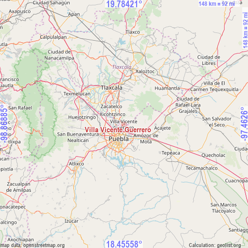
Villa Vicente Guerrero GPS coordinates[2]
19° 7' 16.428" North, 98° 9' 56.592" West
| Map corner | latitude | longitude |
|---|---|---|
| Upper-left | 19.78421°, | -98.86885° |
| Center: | 19.12123°, | -98.16572° |
| Lower-right: | 18.45558°, | -97.4626° |
| Map W x H: | 147.7×147.7 km | = 91.8×91.8mi |
| max Lat: | 32.7° ⇑62.7% North |
| Villa Vicente Guerrero: | 19.12123° |
| min Lat: | ⇓37.3% South 14.53588° |
| min Long | Villa Vicente G | max Long |
| -117.105° | -98.16572° | -86.73105° |
| W 61.7%⇐ | ⇒38.3% E |
Elevation
Elevation of Villa Vicente Guerrero is 2305 m = 7562 ft, and this is 1051.3 m = 3449 ft above average elevation for this country.
| Max E: |
3497 m = 11473 ft | 13.2% |
| Villa Vicente Guerrero | 2305 m 7562 ft | |
| Avg. | 1253.7 m = 4113 ft | |
Min E: |
-1 m = -3 ft | 86.8% |
See also: Villa Vicente Guerrero elevation on elevation.city.
Geographical zone
Villa Vicente Guerrero is located in North Torrid zone (between Equator and Tropic of Cancer). Distance of this Northern Tropic circle is 479.8 km =298.1 mi to North.| Distance of | km | miles | from Villa Vicente Guerrero |
|---|---|---|---|
| North Pole | 7881 | 4897 | to North |
| Arctic Circle | 5275.1 | 3277.8 | to North |
| Tropic Cancer | 479.8 | 298.1 | to North |
| Equator | 2126.1 | 1321.1 | to South |


Nearby cities:
15 places around Villa Vicente Guerrero: (largest is in red/bold)
• 6 de Junio
2.3 km =1.4 mi,  122°
122°
• Almecatla
7.8 km =4.8 mi,  288°
288°
• La Resurrección
4.3 km =2.7 mi, 118°
• Mazatecochco
6.8 km =4.2 mi,  340°
340°
• Papalotla
6.6 km =4.1 mi,  322°
322°
• Primero de Mayo
8.4 km =5.2 mi, 121°
• San Isidro Buen Suceso
7.4 km =4.6 mi,  59°
59°
• San Jacinto
9.4 km =5.8 mi, 292°
• San Marcos Contla
9.4 km =5.8 mi, 337°
• San Miguel Canoa
7.4 km =4.6 mi, 62°
• San Sebastián de Aparicio
2.1 km =1.3 mi,  165°
165°
• Sanctorum
9.6 km =6 mi,  255°
255°
• Santa María Xonacatepec
7.4 km =4.6 mi, 118°
• Tenancingo
4.7 km =2.9 mi,  307°
307°
• Xicohtzinco
9.2 km =5.7 mi, 309°
Sources, notices
• [Note1] Compared only with cities in Mexico existing in our database
• [Src1] Map data: © OpenStreetMap contributors (CC-BY-SA)
• [Src2] Other city data from geonames.org with taken over terms of usage.
• [Src3] Geographical zone / Annual Mean Temperature by Robert A. Rohde @ Wikipedia
