Santiago Yosondúa geodata
Santiago Yosondúa (Oaxaca) is a populated place; located in Mexico in America/Mexico_City (GMT-6) time zone. With population of 1,254 people, there are 6906 cities with bigger population in this country. Compared to other cities in Mexico, 90.7% of cities are located further ↑North; 68.7% of cities are located further ←West and 82.3% of cities have lower elevation than Santiago Yosondúa. Note1


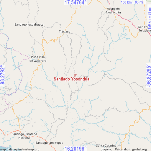
Santiago Yosondúa GPS coordinates[2]
16° 52' 33.636" North, 97° 34' 33.852" West
| Map corner | latitude | longitude |
|---|---|---|
| Upper-left | 17.54764°, | -98.2792° |
| Center: | 16.87601°, | -97.57607° |
| Lower-right: | 16.20198°, | -96.87295° |
| Map W x H: | 149.6×149.6 km | = 93×93mi |
| max Lat: | 32.7° ⇑90.7% North |
| Santiago Yosondúa: | 16.87601° |
| min Lat: | ⇓9.3% South 14.53588° |
| min Long | Santiago Yosond | max Long |
| -117.105° | -97.57607° | -86.73105° |
| W 68.7%⇐ | ⇒31.3% E |
Elevation
Elevation of Santiago Yosondúa is 2196 m = 7205 ft, and this is 942.3 m = 3092 ft above average elevation for this country.
| Max E: |
3497 m = 11473 ft | 17.7% |
| Santiago Yosondúa | 2196 m 7205 ft | |
| Avg. | 1253.7 m = 4113 ft | |
Min E: |
-1 m = -3 ft | 82.3% |
See also: Mexico elevation on elevation.city.
Geographical zone
Santiago Yosondúa is located in North Torrid zone (between Equator and Tropic of Cancer). Distance of this Northern Tropic circle is 729.5 km =453.3 mi to North.| Distance of | km | miles | from Santiago Yosondúa |
|---|---|---|---|
| North Pole | 8130.6 | 5052.1 | to North |
| Arctic Circle | 5524.7 | 3432.9 | to North |
| Tropic Cancer | 729.5 | 453.3 | to North |
| Equator | 1876.4 | 1165.9 | to South |


Nearby cities:
15 places around Santiago Yosondúa: (largest is in red/bold)
• Aldama
10.2 km =6.3 mi,  347°
347°
• Chapultepec
12.1 km =7.5 mi,  359°
359°
• Hidalgo
15.9 km =9.9 mi,  247°
247°
• Ignacio Zaragoza
18 km =11.2 mi, 350°
• Imperio
5.1 km =3.2 mi,  333°
333°
• Morelos
14 km =8.7 mi,  229°
229°
• Progreso
18.8 km =11.7 mi,  1°
1°
• San Mateo Yucutindoo
18.4 km =11.4 mi,  147°
147°
• San Sebastián Yutanino
15.4 km =9.6 mi,  127°
127°
• Santa Catarina Cuanana
13.1 km =8.1 mi,  121°
121°
• Santa Cruz Itundujia
9 km =5.6 mi,  268°
268°
• Santa Cruz Tacahua
10.2 km =6.3 mi,  61°
61°
• Santa María Ocotlán
19 km =11.8 mi,  300°
300°
• Villa Chalcatongo de Hidalgo
17.4 km =10.8 mi, 1°
• Yutecoso Cuauhtémoc
14.2 km =8.8 mi,  291°
291°
Sources, notices
• [Note1] Compared only with cities in Mexico existing in our database
• [Src1] Map data: © OpenStreetMap contributors (CC-BY-SA)
• [Src2] Other city data from geonames.org with taken over terms of usage.
• [Src3] Geographical zone / Annual Mean Temperature by Robert A. Rohde @ Wikipedia
