San Marcial Ozolotepec geodata
San Marcial Ozolotepec (Oaxaca) is a populated place; located in Mexico in America/Mexico_City (GMT-6) time zone. With population of 1,055 people, there are 8271 cities with bigger population in this country. Compared to other cities in Mexico, 97% of cities are located further ↑North; 80.2% of cities are located further ←West and 88.6% of cities have lower elevation than San Marcial Ozolotepec. Note1


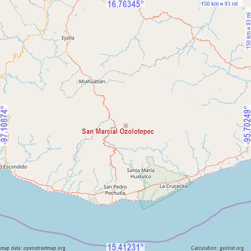
San Marcial Ozolotepec GPS coordinates[2]
16° 5' 20.508" North, 96° 24' 20.196" West
| Map corner | latitude | longitude |
|---|---|---|
| Upper-left | 16.76345°, | -97.10874° |
| Center: | 16.08903°, | -96.40561° |
| Lower-right: | 15.41231°, | -95.70249° |
| Map W x H: | 150.2×150.2 km | = 93.3×93.3mi |
| max Lat: | 32.7° ⇑97% North |
| San Marcial Ozolotepec: | 16.08903° |
| min Lat: | ⇓3% South 14.53588° |
| min Long | San Marcial Ozo | max Long |
| -117.105° | -96.40561° | -86.73105° |
| W 80.2%⇐ | ⇒19.8% E |
Elevation
Elevation of San Marcial Ozolotepec is 2360 m = 7743 ft, and this is 1106.3 m = 3630 ft above average elevation for this country.
| Max E: |
3497 m = 11473 ft | 11.4% |
| San Marcial Ozolotepec | 2360 m 7743 ft | |
| Avg. | 1253.7 m = 4113 ft | |
Min E: |
-1 m = -3 ft | 88.6% |
See also: Mexico elevation on elevation.city.
Geographical zone
San Marcial Ozolotepec is located in North Torrid zone (between Equator and Tropic of Cancer). Distance of this Northern Tropic circle is 817 km =507.7 mi to North.| Distance of | km | miles | from San Marcial Ozolotepec |
|---|---|---|---|
| North Pole | 8218.1 | 5106.5 | to North |
| Arctic Circle | 5612.2 | 3487.3 | to North |
| Tropic Cancer | 817 | 507.7 | to North |
| Equator | 1788.9 | 1111.6 | to South |


Nearby cities:
15 places around San Marcial Ozolotepec: (largest is in red/bold)
• Cieneguilla
10.5 km =6.5 mi,  11°
11°
• La Reforma
16.7 km =10.4 mi,  1°
1°
• Los Naranjos Esquipulas
13.2 km =8.2 mi,  205°
205°
• San Andrés Paxtlán
17.9 km =11.1 mi,  322°
322°
• San Gregorio Ozolotepec
9.4 km =5.8 mi,  59°
59°
• San José del Pacífico
13.7 km =8.5 mi,  311°
311°
• San Juan Ozolotepec
16.4 km =10.2 mi,  72°
72°
• San Mateo Piñas
12.4 km =7.7 mi,  142°
142°
• San Mateo Río Hondo
7.6 km =4.7 mi, 324°
• San Miguel Suchixtepec
6.7 km =4.2 mi,  274°
274°
• San Pedro el Alto
9.4 km =5.8 mi,  230°
230°
• San Sebastián Río Hondo
12.3 km =7.6 mi,  328°
328°
• Santa Cruz Ozolotepec
11.2 km =7 mi,  100°
100°
• Santa María Ozolotepec
6.1 km =3.8 mi,  37°
37°
• Santo Domingo Ozolotepec
12.2 km =7.6 mi, 56°
Sources, notices
• [Note1] Compared only with cities in Mexico existing in our database
• [Src1] Map data: © OpenStreetMap contributors (CC-BY-SA)
• [Src2] Other city data from geonames.org with taken over terms of usage.
• [Src3] Geographical zone / Annual Mean Temperature by Robert A. Rohde @ Wikipedia
