San Juan Ozolotepec geodata
San Juan Ozolotepec (Oaxaca) is a seat of a second-order administrative division; located in Mexico in America/Mexico_City (GMT-6) time zone. With population of 615 people, there are 14017 cities with bigger population in this country. Compared to other cities in Mexico, 96.7% of cities are located further ↑North; 81% of cities are located further ←West and 78.2% of cities have lower elevation than San Juan Ozolotepec. Note1


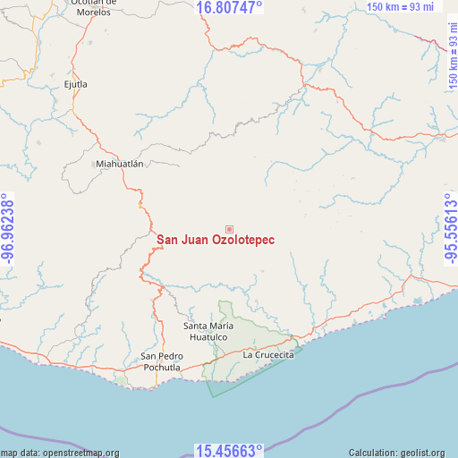
San Juan Ozolotepec GPS coordinates[2]
16° 7' 59.52" North, 96° 15' 33.3" West
| Map corner | latitude | longitude |
|---|---|---|
| Upper-left | 16.80747°, | -96.96238° |
| Center: | 16.1332°, | -96.25925° |
| Lower-right: | 15.45663°, | -95.55613° |
| Map W x H: | 150.2×150.2 km | = 93.3×93.3mi |
| max Lat: | 32.7° ⇑96.7% North |
| San Juan Ozolotepec: | 16.1332° |
| min Lat: | ⇓3.3% South 14.53588° |
| min Long | San Juan Ozolot | max Long |
| -117.105° | -96.25925° | -86.73105° |
| W 81%⇐ | ⇒19% E |
Elevation
Elevation of San Juan Ozolotepec is 2093 m = 6867 ft, and this is 839.3 m = 2754 ft above average elevation for this country.
| Max E: |
3497 m = 11473 ft | 21.8% |
| San Juan Ozolotepec | 2093 m 6867 ft | |
| Avg. | 1253.7 m = 4113 ft | |
Min E: |
-1 m = -3 ft | 78.2% |
See also: Mexico elevation on elevation.city.
Geographical zone
San Juan Ozolotepec is located in North Torrid zone (between Equator and Tropic of Cancer). Distance of this Northern Tropic circle is 812.1 km =504.6 mi to North.| Distance of | km | miles | from San Juan Ozolotepec |
|---|---|---|---|
| North Pole | 8213.2 | 5103.4 | to North |
| Arctic Circle | 5607.3 | 3484.2 | to North |
| Tropic Cancer | 812.1 | 504.6 | to North |
| Equator | 1793.8 | 1114.6 | to South |


Nearby cities:
15 places around San Juan Ozolotepec: (largest is in red/bold)
• Cieneguilla
14.6 km =9.1 mi,  291°
291°
• San Andrés Lovene
12 km =7.5 mi,  150°
150°
• San Felipe Lachilló
17.6 km =10.9 mi,  140°
140°
• San Francisco Ozolotepec
5.4 km =3.4 mi,  132°
132°
• San Gregorio Ozolotepec
7.5 km =4.7 mi,  268°
268°
• San Juan Guivini
7.9 km =4.9 mi,  118°
118°
• San Juan Mixtepec
16.6 km =10.3 mi,  344°
344°
• San Marcial Ozolotepec
16.4 km =10.2 mi,  252°
252°
• San Mateo Piñas
16.8 km =10.4 mi,  208°
208°
• San Pedro Mixtepec
15.5 km =9.6 mi,  350°
350°
• Santa Cruz Ozolotepec
8.4 km =5.2 mi, 213°
• Santa María Ozolotepec
11.9 km =7.4 mi, 269°
• Santiago Lapaguía
7.3 km =4.5 mi,  88°
88°
• Santiago Xanica
14.2 km =8.8 mi,  164°
164°
• Santo Domingo Ozolotepec
5.8 km =3.6 mi, 289°
Sources, notices
• [Note1] Compared only with cities in Mexico existing in our database
• [Src1] Map data: © OpenStreetMap contributors (CC-BY-SA)
• [Src2] Other city data from geonames.org with taken over terms of usage.
• [Src3] Geographical zone / Annual Mean Temperature by Robert A. Rohde @ Wikipedia
