San Luis Tehuizotla geodata
San Luis Tehuizotla (Puebla) is a populated place; located in Mexico in America/Mexico_City (GMT-6) time zone. With population of 854 people, there are 10250 cities with bigger population in this country. Compared to other cities in Mexico, 70.5% of cities are located further ↑North; 65.3% of cities are located further ←West and 66.3% of cities have lower elevation than San Luis Tehuizotla. Note1


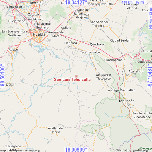
San Luis Tehuizotla GPS coordinates[2]
18° 40' 35.364" North, 97° 51' 28.548" West
| Map corner | latitude | longitude |
|---|---|---|
| Upper-left | 19.34127°, | -98.56106° |
| Center: | 18.67649°, | -97.85793° |
| Lower-right: | 18.00909°, | -97.15481° |
| Map W x H: | 148.1×148.1 km | = 92×92mi |
| max Lat: | 32.7° ⇑70.5% North |
| San Luis Tehuizotla: | 18.67649° |
| min Lat: | ⇓29.5% South 14.53588° |
| min Long | San Luis Tehuiz | max Long |
| -117.105° | -97.85793° | -86.73105° |
| W 65.3%⇐ | ⇒34.7% E |
Elevation
Elevation of San Luis Tehuizotla is 1857 m = 6093 ft, and this is 603.3 m = 1979 ft above average elevation for this country.
| Max E: |
3497 m = 11473 ft | 33.7% |
| San Luis Tehuizotla | 1857 m 6093 ft | |
| Avg. | 1253.7 m = 4113 ft | |
Min E: |
-1 m = -3 ft | 66.3% |
See also: Mexico elevation on elevation.city.
Geographical zone
San Luis Tehuizotla is located in North Torrid zone (between Equator and Tropic of Cancer). Distance of this Northern Tropic circle is 529.3 km =328.9 mi to North.| Distance of | km | miles | from San Luis Tehuizotla |
|---|---|---|---|
| North Pole | 7930.4 | 4927.7 | to North |
| Arctic Circle | 5324.5 | 3308.5 | to North |
| Tropic Cancer | 529.3 | 328.9 | to North |
| Equator | 2076.6 | 1290.3 | to South |


Nearby cities:
15 places around San Luis Tehuizotla: (largest is in red/bold)
• Colonia Morelos (Pie de Vaca)
10.9 km =6.8 mi,  214°
214°
• Dolores Hidalgo
9 km =5.6 mi,  358°
358°
• El Progreso
12.9 km =8 mi,  179°
179°
• El Rosario Xochitiopan
11.3 km =7 mi,  247°
247°
• Guadalupe Victoria
15.6 km =9.7 mi,  92°
92°
• Huacaltzingo
13.7 km =8.5 mi, 358°
• San Andrés Mimiahuapan
3.3 km =2.1 mi,  292°
292°
• San José de Gracia
3.8 km =2.4 mi,  163°
163°
• San Lucas el Viejo
14.7 km =9.1 mi, 89°
• Santa Clara Huitziltepec
10.6 km =6.6 mi,  346°
346°
• Santa Cruz Huitziltepec
6.6 km =4.1 mi,  343°
343°
• Tepexi de Rodríguez
12.8 km =8 mi, 214°
• Tepeyahualco
15.5 km =9.6 mi, 352°
• Victoria
9.1 km =5.7 mi, 254°
• Xochitlan Todos Santos
9.1 km =5.7 mi,  70°
70°
Sources, notices
• [Note1] Compared only with cities in Mexico existing in our database
• [Src1] Map data: © OpenStreetMap contributors (CC-BY-SA)
• [Src2] Other city data from geonames.org with taken over terms of usage.
• [Src3] Geographical zone / Annual Mean Temperature by Robert A. Rohde @ Wikipedia
