San Juan Atenco geodata
San Juan Atenco (Puebla) is a populated place; located in Mexico in America/Mexico_City (GMT-6) time zone. With population of 1,977 people, there are 4411 cities with bigger population in this country. Compared to other cities in Mexico, 63.3% of cities are located further ↑North; 69.1% of cities are located further ←West and 91.3% of cities have lower elevation than San Juan Atenco. Note1


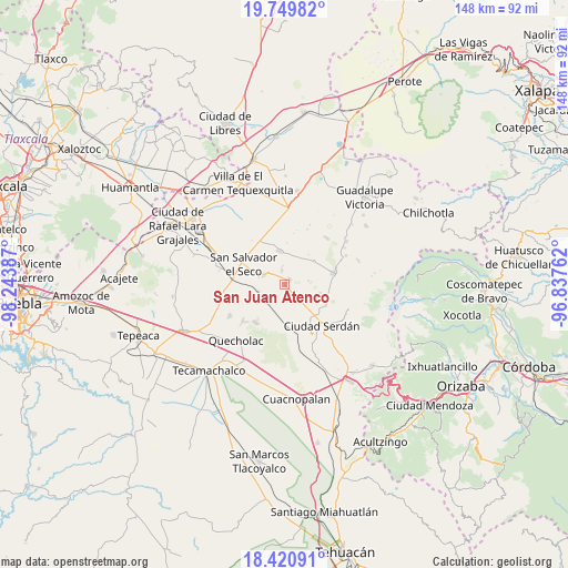
San Juan Atenco GPS coordinates[2]
19° 5' 12.12" North, 97° 32' 26.664" West
| Map corner | latitude | longitude |
|---|---|---|
| Upper-left | 19.74982°, | -98.24387° |
| Center: | 19.0867°, | -97.54074° |
| Lower-right: | 18.42091°, | -96.83762° |
| Map W x H: | 147.8×147.8 km | = 91.8×91.8mi |
| max Lat: | 32.7° ⇑63.3% North |
| San Juan Atenco: | 19.0867° |
| min Lat: | ⇓36.7% South 14.53588° |
| min Long | San Juan Atenco | max Long |
| -117.105° | -97.54074° | -86.73105° |
| W 69.1%⇐ | ⇒30.9% E |
Elevation
Elevation of San Juan Atenco is 2453 m = 8048 ft, and this is 1199.3 m = 3935 ft above average elevation for this country.
| Max E: |
3497 m = 11473 ft | 8.7% |
| San Juan Atenco | 2453 m 8048 ft | |
| Avg. | 1253.7 m = 4113 ft | |
Min E: |
-1 m = -3 ft | 91.3% |
See also: Mexico elevation on elevation.city.
Geographical zone
San Juan Atenco is located in North Torrid zone (between Equator and Tropic of Cancer). Distance of this Northern Tropic circle is 483.7 km =300.6 mi to North.| Distance of | km | miles | from San Juan Atenco |
|---|---|---|---|
| North Pole | 7884.8 | 4899.4 | to North |
| Arctic Circle | 5278.9 | 3280.2 | to North |
| Tropic Cancer | 483.7 | 300.6 | to North |
| Equator | 2122.2 | 1318.7 | to South |


Nearby cities:
15 places around San Juan Atenco: (largest is in red/bold)
• Ahuatepec de Camino
12.3 km =7.6 mi,  114°
114°
• Aljojuca
1.8 km =1.1 mi,  39°
39°
• Guadalupe Victoria
7.1 km =4.4 mi,  286°
286°
• José María Morelos
9.8 km =6.1 mi,  51°
51°
• San Diego Texmelucan
11.8 km =7.3 mi,  128°
128°
• San Francisco Independencia (Santa María Aserradero)
11.8 km =7.3 mi,  99°
99°
• San José Guerrero
10.3 km =6.4 mi,  178°
178°
• San Miguel Ocotenco
9.5 km =5.9 mi, 103°
• San Miguel Tecuitlapa
3.9 km =2.4 mi,  350°
350°
• San Nicolas Buenos Aires
8.8 km =5.5 mi, 352°
• San Salvador El Seco
11.8 km =7.3 mi,  296°
296°
• Santa Catarina Villanueva
12.5 km =7.8 mi,  218°
218°
• Santa Cruz Coyotepec
7.5 km =4.7 mi,  196°
196°
• Santa Maria Coatepec
6 km =3.7 mi, 294°
• Tlachichuca
13.2 km =8.2 mi,  76°
76°
Sources, notices
• [Note1] Compared only with cities in Mexico existing in our database
• [Src1] Map data: © OpenStreetMap contributors (CC-BY-SA)
• [Src2] Other city data from geonames.org with taken over terms of usage.
• [Src3] Geographical zone / Annual Mean Temperature by Robert A. Rohde @ Wikipedia
