Santa Maria Coatepec geodata
Santa Maria Coatepec (Puebla) is a populated place; located in Mexico in America/Mexico_City (GMT-6) time zone. With population of 5,524 people, there are 1690 cities with bigger population in this country. Compared to other cities in Mexico, 62.9% of cities are located further ↑North; 68.5% of cities are located further ←West and 92.4% of cities have lower elevation than Santa Maria Coatepec. Note1


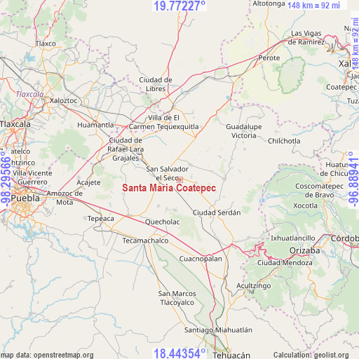
Santa Maria Coatepec GPS coordinates[2]
19° 6' 33.264" North, 97° 35' 33.108" West
| Map corner | latitude | longitude |
|---|---|---|
| Upper-left | 19.77227°, | -98.29566° |
| Center: | 19.10924°, | -97.59253° |
| Lower-right: | 18.44354°, | -96.88941° |
| Map W x H: | 147.7×147.7 km | = 91.8×91.8mi |
| max Lat: | 32.7° ⇑62.9% North |
| Santa Maria Coatepec: | 19.10924° |
| min Lat: | ⇓37.1% South 14.53588° |
| min Long | Santa Maria Coa | max Long |
| -117.105° | -97.59253° | -86.73105° |
| W 68.5%⇐ | ⇒31.5% E |
Elevation
Elevation of Santa Maria Coatepec is 2504 m = 8215 ft, and this is 1250.3 m = 4102 ft above average elevation for this country.
| Max E: |
3497 m = 11473 ft | 7.6% |
| Santa Maria Coatepec | 2504 m 8215 ft | |
| Avg. | 1253.7 m = 4113 ft | |
Min E: |
-1 m = -3 ft | 92.4% |
See also: Mexico elevation on elevation.city.
Geographical zone
Santa Maria Coatepec is located in North Torrid zone (between Equator and Tropic of Cancer). Distance of this Northern Tropic circle is 481.2 km =299 mi to North.| Distance of | km | miles | from Santa Maria Coatepec |
|---|---|---|---|
| North Pole | 7882.3 | 4897.8 | to North |
| Arctic Circle | 5276.4 | 3278.6 | to North |
| Tropic Cancer | 481.2 | 299 | to North |
| Equator | 2124.7 | 1320.2 | to South |


Nearby cities:
15 places around Santa Maria Coatepec: (largest is in red/bold)
• Aljojuca
6.7 km =4.2 mi,  99°
99°
• Guadalupe Victoria
1.5 km =0.9 mi,  248°
248°
• José María Morelos
13.6 km =8.5 mi,  74°
74°
• Mazapiltepec
11.6 km =7.2 mi,  275°
275°
• Miguel Hidalgo
13.3 km =8.3 mi,  35°
35°
• San José Barroso
9.4 km =5.8 mi,  340°
340°
• San Juan Atenco
6 km =3.7 mi,  114°
114°
• San Martín Rinconada
7.9 km =4.9 mi, 280°
• San Miguel Tecuitlapa
4.9 km =3 mi, 74°
• San Nicolas Buenos Aires
7.6 km =4.7 mi,  34°
34°
• San Salvador El Seco
5.8 km =3.6 mi,  297°
297°
• Santa Catarina Villanueva
12.5 km =7.8 mi,  190°
190°
• Santa Cruz Coyotepec
10.2 km =6.3 mi,  160°
160°
• Santiago Tenango
13 km =8.1 mi,  204°
204°
• Soltepec
12.3 km =7.6 mi, 276°
Sources, notices
• [Note1] Compared only with cities in Mexico existing in our database
• [Src1] Map data: © OpenStreetMap contributors (CC-BY-SA)
• [Src2] Other city data from geonames.org with taken over terms of usage.
• [Src3] Geographical zone / Annual Mean Temperature by Robert A. Rohde @ Wikipedia
