San Juan geodata
San Juan (Nuevo León) is a populated place; located in Mexico in America/Monterrey (GMT-6) time zone. With population of 1,478 people, there are 5841 cities with bigger population in this country. Compared to other cities in Mexico, 92.9% of cities are located further ↓South; 62% of cities are located further →East and 73.5% of cities have higher elevation than San Juan. Note1


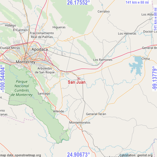
San Juan GPS coordinates[2]
25° 32' 34.08" North, 99° 50' 27.276" West
| Map corner | latitude | longitude |
|---|---|---|
| Upper-left | 26.17552°, | -100.54404° |
| Center: | 25.5428°, | -99.84091° |
| Lower-right: | 24.90673°, | -99.13779° |
| Map W x H: | 141.1×141.1 km | = 87.7×87.7mi |
| max Lat: | 32.7° ⇑7.1% North |
| San Juan: | 25.5428° |
| min Lat: | ⇓92.9% South 14.53588° |
| min Long | San Juan | max Long |
| -117.105° | -99.84091° | -86.73105° |
| W 38%⇐ | ⇒62% E |
Elevation
Elevation of San Juan is 273 m = 896 ft, and this is 980.7 m = 3218 ft below average elevation for this country.
| Max E: |
3497 m = 11473 ft | 73.5% |
| Avg. | 1253.7 m = 4113 ft | |
| San Juan | 273 m = 896 ft | |
Min E: |
-1 m = -3 ft | 26.5% |
See also: Mexico elevation on elevation.city.
Geographical zone
San Juan is located in North temperate zone (between Tropic of Cancer and the Arctic Circle). Distance of this Northern Tropic circle is 234.2 km =145.5 mi to South.| Distance of | km | miles | from San Juan |
|---|---|---|---|
| North Pole | 7167 | 4453.4 | to North |
| Arctic Circle | 4561.1 | 2834.1 | to North |
| Tropic Cancer | 234.2 | 145.5 | to South |
| Equator | 2840.1 | 1764.8 | to South |


Nearby cities:
15 places around San Juan: (largest is in red/bold)
• Atongo de Abajo
25.2 km =15.7 mi,  215°
215°
• Cadereyta
15 km =9.3 mi,  287°
287°
• Cadereyta Jiménez
16.9 km =10.5 mi, 287°
• Ciudad Benito Juárez
28.1 km =17.5 mi, 294°
• Dieciséis de Septiembre
31.5 km =19.6 mi,  279°
279°
• Dulces Nombres
31.9 km =19.8 mi,  310°
310°
• El Fraile
22.6 km =14 mi,  204°
204°
• Héctor Caballero
30.5 km =19 mi, 289°
• Los Ramones
27.6 km =17.1 mi,  51°
51°
• Palmitos
15.8 km =9.8 mi,  235°
235°
• Paso Hondo
31.8 km =19.8 mi, 203°
• Pueblo Nuevo
10.4 km =6.5 mi,  128°
128°
• San Antonio
24.3 km =15.1 mi,  296°
296°
• San Isidro
16.8 km =10.4 mi,  30°
30°
• Santa Isabel y Dolores
6.5 km =4 mi,  97°
97°
Sources, notices
• [Note1] Compared only with cities in Mexico existing in our database
• [Src1] Map data: © OpenStreetMap contributors (CC-BY-SA)
• [Src2] Other city data from geonames.org with taken over terms of usage.
• [Src3] Geographical zone / Annual Mean Temperature by Robert A. Rohde @ Wikipedia
