Santa Isabel y Dolores geodata
Santa Isabel y Dolores (Nuevo León) is a populated place; located in Mexico in America/Monterrey (GMT-6) time zone. With population of 507 people, there are 16589 cities with bigger population in this country. Compared to other cities in Mexico, 92.8% of cities are located further ↓South; 61.2% of cities are located further →East and 73.8% of cities have higher elevation than Santa Isabel y Dolores. Note1


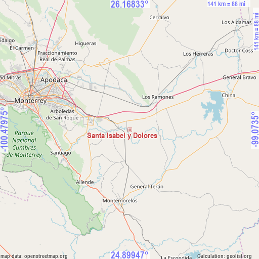
Santa Isabel y Dolores GPS coordinates[2]
25° 32' 8.088" North, 99° 46' 35.832" West
| Map corner | latitude | longitude |
|---|---|---|
| Upper-left | 26.16833°, | -100.47975° |
| Center: | 25.53558°, | -99.77662° |
| Lower-right: | 24.89947°, | -99.0735° |
| Map W x H: | 141.1×141.1 km | = 87.7×87.7mi |
| max Lat: | 32.7° ⇑7.2% North |
| Santa Isabel y Dolores: | 25.53558° |
| min Lat: | ⇓92.8% South 14.53588° |
| min Long | Santa Isabel y | max Long |
| -117.105° | -99.77662° | -86.73105° |
| W 38.8%⇐ | ⇒61.2% E |
Elevation
Elevation of Santa Isabel y Dolores is 261 m = 856 ft, and this is 992.7 m = 3257 ft below average elevation for this country.
| Max E: |
3497 m = 11473 ft | 73.8% |
| Avg. | 1253.7 m = 4113 ft | |
| Santa Isabel y Dolores | 261 m = 856 ft | |
Min E: |
-1 m = -3 ft | 26.2% |
See also: Mexico elevation on elevation.city.
Geographical zone
Santa Isabel y Dolores is located in North temperate zone (between Tropic of Cancer and the Arctic Circle). Distance of this Northern Tropic circle is 233.4 km =145 mi to South.| Distance of | km | miles | from Santa Isabel y Dolores |
|---|---|---|---|
| North Pole | 7167.8 | 4453.9 | to North |
| Arctic Circle | 4561.9 | 2834.6 | to North |
| Tropic Cancer | 233.4 | 145 | to South |
| Equator | 2839.3 | 1764.3 | to South |


Nearby cities:
15 places around Santa Isabel y Dolores: (largest is in red/bold)
• Atongo de Abajo
28.8 km =17.9 mi,  227°
227°
• Cadereyta
21.4 km =13.3 mi,  284°
284°
• Cadereyta Jiménez
23.3 km =14.5 mi, 284°
• Ciudad Benito Juárez
34.3 km =21.3 mi,  291°
291°
• Ciudad General Terán
32.2 km =20 mi,  163°
163°
• Ciudad de Allende
37.4 km =23.2 mi,  219°
219°
• El Fraile
25.3 km =15.7 mi, 218°
• Héctor Caballero
36.8 km =22.9 mi, 287°
• Los Ramones
23.5 km =14.6 mi,  40°
40°
• Palmitos
21.1 km =13.1 mi,  247°
247°
• Paso Hondo
34.2 km =21.3 mi,  214°
214°
• Pueblo Nuevo
6 km =3.7 mi, 163°
• San Antonio
30.5 km =19 mi, 292°
• San Isidro
15.5 km =9.6 mi,  7°
7°
• San Juan
6.5 km =4 mi, 277°
Sources, notices
• [Note1] Compared only with cities in Mexico existing in our database
• [Src1] Map data: © OpenStreetMap contributors (CC-BY-SA)
• [Src2] Other city data from geonames.org with taken over terms of usage.
• [Src3] Geographical zone / Annual Mean Temperature by Robert A. Rohde @ Wikipedia
