San José Acateno geodata
San José Acateno (Puebla) is a seat of a second-order administrative division; located in Mexico in America/Mexico_City (GMT-6) time zone. With population of 3,352 people, there are 2712 cities with bigger population in this country. Compared to other cities in Mexico, 59.8% of cities are located further ↓South; 72.3% of cities are located further ←West and 77.5% of cities have higher elevation than San José Acateno. Note1


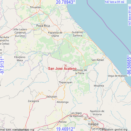
San José Acateno GPS coordinates[2]
20° 7' 50.412" North, 97° 12' 35.892" West
| Map corner | latitude | longitude |
|---|---|---|
| Upper-left | 20.78943°, | -97.9131° |
| Center: | 20.13067°, | -97.20997° |
| Lower-right: | 19.46912°, | -96.50685° |
| Map W x H: | 146.8×146.8 km | = 91.2×91.2mi |
| max Lat: | 32.7° ⇑40.2% North |
| San José Acateno: | 20.13067° |
| min Lat: | ⇓59.8% South 14.53588° |
| min Long | San José Acate | max Long |
| -117.105° | -97.20997° | -86.73105° |
| W 72.3%⇐ | ⇒27.7% E |
Elevation
Elevation of San José Acateno is 141 m = 463 ft, and this is 1112.7 m = 3651 ft below average elevation for this country.
| Max E: |
3497 m = 11473 ft | 77.5% |
| Avg. | 1253.7 m = 4113 ft | |
| San José Acateno | 141 m = 463 ft | |
Min E: |
-1 m = -3 ft | 22.5% |
See also: Mexico elevation on elevation.city.
Geographical zone
San José Acateno is located in North Torrid zone (between Equator and Tropic of Cancer). Distance of this Northern Tropic circle is 367.6 km =228.4 mi to North.| Distance of | km | miles | from San José Acateno |
|---|---|---|---|
| North Pole | 7768.7 | 4827.2 | to North |
| Arctic Circle | 5162.9 | 3208.1 | to North |
| Tropic Cancer | 367.6 | 228.4 | to North |
| Equator | 2238.3 | 1390.8 | to South |


Nearby cities:
15 places around San José Acateno: (largest is in red/bold)
• Atehuetzin
13.8 km =8.6 mi,  199°
199°
• Balsas de Agua
14.2 km =8.8 mi,  39°
39°
• Belisario Domínguez
13.3 km =8.3 mi,  313°
313°
• El Jobo
13.8 km =8.6 mi,  159°
159°
• El Porvenir Número Dos
8.8 km =5.5 mi, 39°
• Huipiltepec
11 km =6.8 mi,  66°
66°
• Insurgente Socialista
8.4 km =5.2 mi,  319°
319°
• Jiliapan
6.4 km =4 mi, 161°
• Joloapan
13.9 km =8.6 mi,  329°
329°
• La Palmilla
14 km =8.7 mi,  151°
151°
• La Reforma
11.6 km =7.2 mi,  122°
122°
• Manantiales
11.4 km =7.1 mi, 65°
• Mesa Chica la Gloria
12.7 km =7.9 mi, 38°
• San Pedro Tlapacoyan
14.2 km =8.8 mi, 124°
• Valsequíllo
5.5 km =3.4 mi,  336°
336°
Sources, notices
• [Note1] Compared only with cities in Mexico existing in our database
• [Src1] Map data: © OpenStreetMap contributors (CC-BY-SA)
• [Src2] Other city data from geonames.org with taken over terms of usage.
• [Src3] Geographical zone / Annual Mean Temperature by Robert A. Rohde @ Wikipedia
