Belisario Domínguez geodata
Belisario Domínguez (Veracruz) is a populated place; located in Mexico in America/Mexico_City (GMT-6) time zone. With population of 731 people, there are 11944 cities with bigger population in this country. Compared to other cities in Mexico, 61.6% of cities are located further ↓South; 71.5% of cities are located further ←West and 79.4% of cities have higher elevation than Belisario Domínguez. Note1


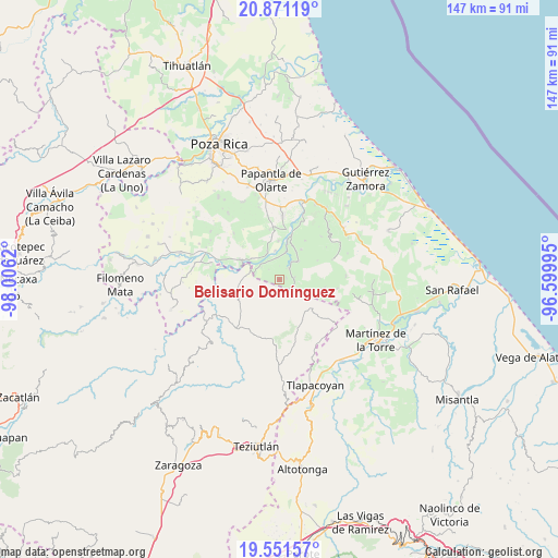
Belisario Domínguez GPS coordinates[2]
20° 12' 46.008" North, 97° 18' 11.052" West
| Map corner | latitude | longitude |
|---|---|---|
| Upper-left | 20.87119°, | -98.0062° |
| Center: | 20.21278°, | -97.30307° |
| Lower-right: | 19.55157°, | -96.59995° |
| Map W x H: | 146.7×146.7 km | = 91.2×91.2mi |
| max Lat: | 32.7° ⇑38.4% North |
| Belisario Domínguez: | 20.21278° |
| min Lat: | ⇓61.6% South 14.53588° |
| min Long | Belisario Domí | max Long |
| -117.105° | -97.30307° | -86.73105° |
| W 71.5%⇐ | ⇒28.5% E |
Elevation
Elevation of Belisario Domínguez is 104 m = 341 ft, and this is 1149.7 m = 3772 ft below average elevation for this country.
| Max E: |
3497 m = 11473 ft | 79.4% |
| Avg. | 1253.7 m = 4113 ft | |
| Belisario Domínguez | 104 m = 341 ft | |
Min E: |
-1 m = -3 ft | 20.6% |
See also: Mexico elevation on elevation.city.
Geographical zone
Belisario Domínguez is located in North Torrid zone (between Equator and Tropic of Cancer). Distance of this Northern Tropic circle is 358.5 km =222.8 mi to North.| Distance of | km | miles | from Belisario Domínguez |
|---|---|---|---|
| North Pole | 7759.6 | 4821.6 | to North |
| Arctic Circle | 5153.7 | 3202.4 | to North |
| Tropic Cancer | 358.5 | 222.8 | to North |
| Equator | 2247.5 | 1396.5 | to South |


Nearby cities:
15 places around Belisario Domínguez: (largest is in red/bold)
• Cuyuxquihui
9.8 km =6.1 mi,  36°
36°
• El Cedral
5.6 km =3.5 mi,  322°
322°
• Espinal
11.3 km =7 mi,  296°
296°
• Guadalupe Victoria
9.1 km =5.7 mi,  306°
306°
• Insurgente Socialista
5.1 km =3.2 mi,  123°
123°
• Joloapan
3.9 km =2.4 mi, 42°
• La Lima
12.2 km =7.6 mi,  242°
242°
• Mizantecatl
13.2 km =8.2 mi,  349°
349°
• Pajasco Limonar
7.7 km =4.8 mi, 316°
• Paso de Valencia
7.3 km =4.5 mi,  334°
334°
• Paso del Correo
11.9 km =7.4 mi,  15°
15°
• Pueblillo
6.8 km =4.2 mi,  47°
47°
• Tenampulco
11.6 km =7.2 mi,  246°
246°
• Tenexate
9.6 km =6 mi,  216°
216°
• Valsequíllo
8.6 km =5.3 mi, 118°
Sources, notices
• [Note1] Compared only with cities in Mexico existing in our database
• [Src1] Map data: © OpenStreetMap contributors (CC-BY-SA)
• [Src2] Other city data from geonames.org with taken over terms of usage.
• [Src3] Geographical zone / Annual Mean Temperature by Robert A. Rohde @ Wikipedia
