Valsequíllo geodata
Valsequíllo (Veracruz) is a populated place; located in Mexico in America/Mexico_City (GMT-6) time zone. With population of 663 people, there are 13102 cities with bigger population in this country. Compared to other cities in Mexico, 60.8% of cities are located further ↓South; 72.1% of cities are located further ←West and 75.2% of cities have higher elevation than Valsequíllo. Note1


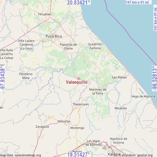
Valsequíllo GPS coordinates[2]
20° 10' 32.304" North, 97° 13' 52.5" West
| Map corner | latitude | longitude |
|---|---|---|
| Upper-left | 20.83421°, | -97.93438° |
| Center: | 20.17564°, | -97.23125° |
| Lower-right: | 19.51427°, | -96.52813° |
| Map W x H: | 146.8×146.8 km | = 91.2×91.2mi |
| max Lat: | 32.7° ⇑39.2% North |
| Valsequíllo: | 20.17564° |
| min Lat: | ⇓60.8% South 14.53588° |
| min Long | Valsequíllo | max Long |
| -117.105° | -97.23125° | -86.73105° |
| W 72.1%⇐ | ⇒27.9% E |
Elevation
Elevation of Valsequíllo is 215 m = 705 ft, and this is 1038.7 m = 3408 ft below average elevation for this country.
| Max E: |
3497 m = 11473 ft | 75.2% |
| Avg. | 1253.7 m = 4113 ft | |
| Valsequíllo | 215 m = 705 ft | |
Min E: |
-1 m = -3 ft | 24.8% |
See also: Mexico elevation on elevation.city.
Geographical zone
Valsequíllo is located in North Torrid zone (between Equator and Tropic of Cancer). Distance of this Northern Tropic circle is 362.6 km =225.3 mi to North.| Distance of | km | miles | from Valsequíllo |
|---|---|---|---|
| North Pole | 7763.7 | 4824.1 | to North |
| Arctic Circle | 5157.9 | 3205 | to North |
| Tropic Cancer | 362.6 | 225.3 | to North |
| Equator | 2243.3 | 1393.9 | to South |


Nearby cities:
15 places around Valsequíllo: (largest is in red/bold)
• Balsas de Agua
12.8 km =8 mi,  62°
62°
• Belisario Domínguez
8.6 km =5.3 mi,  298°
298°
• Cuyuxquihui
12.1 km =7.5 mi,  352°
352°
• El Cedral
13.9 km =8.6 mi,  308°
308°
• El Porvenir Número Dos
8.1 km =5 mi,  77°
77°
• Huipiltepec
12.3 km =7.6 mi,  92°
92°
• Insurgente Socialista
3.5 km =2.2 mi,  292°
292°
• Jiliapan
11.9 km =7.4 mi,  158°
158°
• Joloapan
8.5 km =5.3 mi,  325°
325°
• Manantiales
12.6 km =7.8 mi, 91°
• Mesa Chica la Gloria
11.2 km =7 mi, 63°
• Paso de Valencia
15.1 km =9.4 mi,  315°
315°
• Pueblillo
9.1 km =5.7 mi,  344°
344°
• San José Acateno
5.5 km =3.4 mi, 156°
• Tenexate
13.7 km =8.5 mi,  254°
254°
Sources, notices
• [Note1] Compared only with cities in Mexico existing in our database
• [Src1] Map data: © OpenStreetMap contributors (CC-BY-SA)
• [Src2] Other city data from geonames.org with taken over terms of usage.
• [Src3] Geographical zone / Annual Mean Temperature by Robert A. Rohde @ Wikipedia
