El Jobo geodata
El Jobo (Veracruz) is a populated place; located in Mexico in America/Mexico_City (GMT-6) time zone. With population of 1,939 people, there are 4489 cities with bigger population in this country. Compared to other cities in Mexico, 57.3% of cities are located further ↓South; 72.8% of cities are located further ←West and 75.8% of cities have higher elevation than El Jobo. Note1


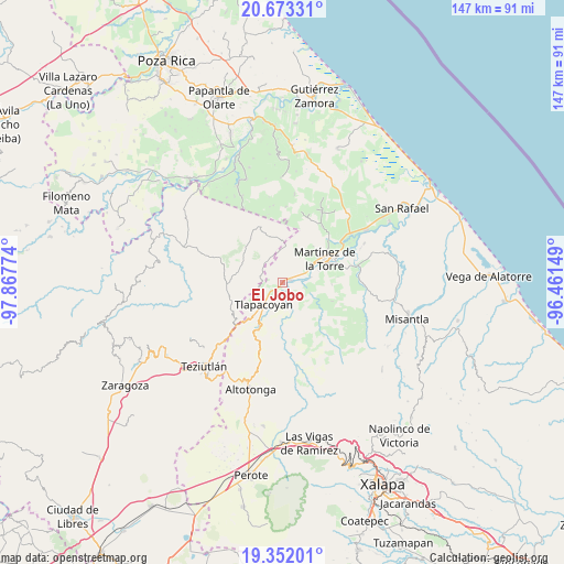
El Jobo GPS coordinates[2]
20° 0' 50.58" North, 97° 9' 52.596" West
| Map corner | latitude | longitude |
|---|---|---|
| Upper-left | 20.67331°, | -97.86774° |
| Center: | 20.01405°, | -97.16461° |
| Lower-right: | 19.35201°, | -96.46149° |
| Map W x H: | 146.9×146.9 km | = 91.3×91.3mi |
| max Lat: | 32.7° ⇑42.7% North |
| El Jobo: | 20.01405° |
| min Lat: | ⇓57.3% South 14.53588° |
| min Long | El Jobo | max Long |
| -117.105° | -97.16461° | -86.73105° |
| W 72.8%⇐ | ⇒27.2% E |
Elevation
Elevation of El Jobo is 194 m = 636 ft, and this is 1059.7 m = 3477 ft below average elevation for this country.
| Max E: |
3497 m = 11473 ft | 75.8% |
| Avg. | 1253.7 m = 4113 ft | |
| El Jobo | 194 m = 636 ft | |
Min E: |
-1 m = -3 ft | 24.2% |
See also: Mexico elevation on elevation.city.
Geographical zone
El Jobo is located in North Torrid zone (between Equator and Tropic of Cancer). Distance of this Northern Tropic circle is 380.6 km =236.5 mi to North.| Distance of | km | miles | from El Jobo |
|---|---|---|---|
| North Pole | 7781.7 | 4835.3 | to North |
| Arctic Circle | 5175.8 | 3216.1 | to North |
| Tropic Cancer | 380.6 | 236.5 | to North |
| Equator | 2225.4 | 1382.8 | to South |


Nearby cities:
15 places around El Jobo: (largest is in red/bold)
• Atehuetzin
9.4 km =5.8 mi,  269°
269°
• El Campamento
7.1 km =4.4 mi,  183°
183°
• Ixtacuaco
8.9 km =5.5 mi,  59°
59°
• Javier Rojo Gómez (Novara)
7.5 km =4.7 mi,  80°
80°
• Jiliapan
7.4 km =4.6 mi,  338°
338°
• La Palmilla
2.1 km =1.3 mi,  70°
70°
• La Reforma
8.4 km =5.2 mi,  36°
36°
• Luis Echeverría
8.9 km =5.5 mi, 55°
• Piedra Pinta
4.1 km =2.5 mi,  231°
231°
• Pompeya
10.6 km =6.6 mi, 83°
• San Isidro
8.4 km =5.2 mi, 229°
• San Pedro Tlapacoyan
8.5 km =5.3 mi,  54°
54°
• Santa Cruz
10.2 km =6.3 mi,  213°
213°
• Santiago
10.8 km =6.7 mi,  174°
174°
• Tlapacoyan
7.5 km =4.7 mi,  220°
220°
Sources, notices
• [Note1] Compared only with cities in Mexico existing in our database
• [Src1] Map data: © OpenStreetMap contributors (CC-BY-SA)
• [Src2] Other city data from geonames.org with taken over terms of usage.
• [Src3] Geographical zone / Annual Mean Temperature by Robert A. Rohde @ Wikipedia
