San Matías Cuijingo geodata
San Matías Cuijingo (State of Mexico) is a populated place; located in Mexico in America/Mexico_City (GMT-6) time zone. With population of 6,263 people, there are 1484 cities with bigger population in this country. Compared to other cities in Mexico, 63.3% of cities are located further ↑North; 52.7% of cities are located further ←West and 92.7% of cities have lower elevation than San Matías Cuijingo. Note1


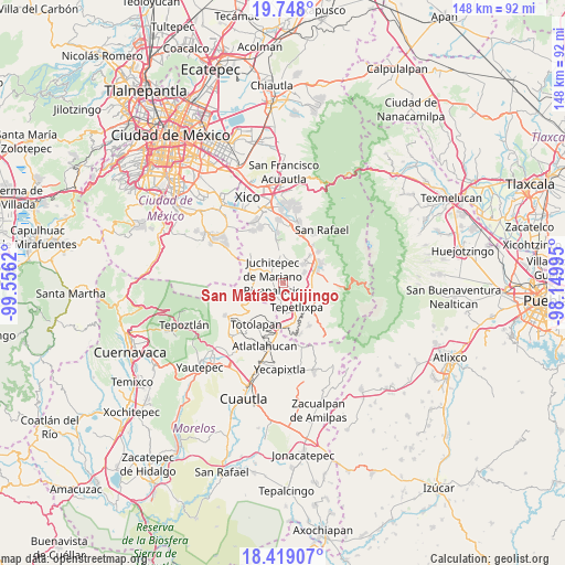
San Matías Cuijingo GPS coordinates[2]
19° 5' 5.532" North, 98° 51' 11.052" West
| Map corner | latitude | longitude |
|---|---|---|
| Upper-left | 19.748°, | -99.5562° |
| Center: | 19.08487°, | -98.85307° |
| Lower-right: | 18.41907°, | -98.14995° |
| Map W x H: | 147.8×147.8 km | = 91.8×91.8mi |
| max Lat: | 32.7° ⇑63.3% North |
| San Matías Cuijingo: | 19.08487° |
| min Lat: | ⇓36.7% South 14.53588° |
| min Long | San Matías Cui | max Long |
| -117.105° | -98.85307° | -86.73105° |
| W 52.7%⇐ | ⇒47.3% E |
Elevation
Elevation of San Matías Cuijingo is 2514 m = 8248 ft, and this is 1260.3 m = 4135 ft above average elevation for this country.
| Max E: |
3497 m = 11473 ft | 7.3% |
| San Matías Cuijingo | 2514 m 8248 ft | |
| Avg. | 1253.7 m = 4113 ft | |
Min E: |
-1 m = -3 ft | 92.7% |
See also: Mexico elevation on elevation.city.
Geographical zone
San Matías Cuijingo is located in North Torrid zone (between Equator and Tropic of Cancer). Distance of this Northern Tropic circle is 483.9 km =300.7 mi to North.| Distance of | km | miles | from San Matías Cuijingo |
|---|---|---|---|
| North Pole | 7885 | 4899.5 | to North |
| Arctic Circle | 5279.1 | 3280.3 | to North |
| Tropic Cancer | 483.9 | 300.7 | to North |
| Equator | 2122 | 1318.5 | to South |


Nearby cities:
15 places around San Matías Cuijingo: (largest is in red/bold)
• Ayapango
7.3 km =4.5 mi,  50°
50°
• Cuecuecuatitla
8 km =5 mi,  172°
172°
• Juchitepec
3.2 km =2 mi,  302°
302°
• Las Delicias
7.7 km =4.8 mi,  101°
101°
• Mihuacan
5.4 km =3.4 mi,  60°
60°
• Ozumba de Alzate
8.1 km =5 mi,  131°
131°
• Pahuacán
5.5 km =3.4 mi, 63°
• Popo Park
7.9 km =4.9 mi,  106°
106°
• San Juan Coxtocan
6.1 km =3.8 mi,  5°
5°
• San Mateo Tecalco
7 km =4.3 mi,  120°
120°
• Santiago Tepopula
6.6 km =4.1 mi,  356°
356°
• Tenango del Aire
8.1 km =5 mi, 357°
• Tepetlixpa
7.1 km =4.4 mi,  151°
151°
• Tlamapa
6.5 km =4 mi,  15°
15°
• Zoyatzingo
7.3 km =4.5 mi,  85°
85°
Sources, notices
• [Note1] Compared only with cities in Mexico existing in our database
• [Src1] Map data: © OpenStreetMap contributors (CC-BY-SA)
• [Src2] Other city data from geonames.org with taken over terms of usage.
• [Src3] Geographical zone / Annual Mean Temperature by Robert A. Rohde @ Wikipedia
