Tejas de Morelos geodata
Tejas de Morelos (Oaxaca) is a populated place; located in Mexico in America/Mexico_City (GMT-6) time zone. With population of 635 people, there are 13639 cities with bigger population in this country. Compared to other cities in Mexico, 92.2% of cities are located further ↑North; 77.7% of cities are located further ←West and 50.8% of cities have lower elevation than Tejas de Morelos. Note1


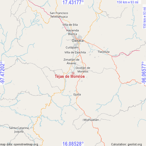
Tejas de Morelos GPS coordinates[2]
16° 45' 34.992" North, 96° 46' 8.004" West
| Map corner | latitude | longitude |
|---|---|---|
| Upper-left | 17.43177°, | -97.47202° |
| Center: | 16.75972°, | -96.76889° |
| Lower-right: | 16.08528°, | -96.06577° |
| Map W x H: | 149.7×149.7 km | = 93×93mi |
| max Lat: | 32.7° ⇑92.2% North |
| Tejas de Morelos: | 16.75972° |
| min Lat: | ⇓7.8% South 14.53588° |
| min Long | Tejas de Morelo | max Long |
| -117.105° | -96.76889° | -86.73105° |
| W 77.7%⇐ | ⇒22.3% E |
Elevation
Elevation of Tejas de Morelos is 1477 m = 4846 ft, and this is 223.3 m = 733 ft above average elevation for this country.
| Max E: |
3497 m = 11473 ft | 49.2% |
| Tejas de Morelos | 1477 m 4846 ft | |
| Avg. | 1253.7 m = 4113 ft | |
Min E: |
-1 m = -3 ft | 50.8% |
See also: Mexico elevation on elevation.city.
Geographical zone
Tejas de Morelos is located in North Torrid zone (between Equator and Tropic of Cancer). Distance of this Northern Tropic circle is 742.4 km =461.3 mi to North.| Distance of | km | miles | from Tejas de Morelos |
|---|---|---|---|
| North Pole | 8143.6 | 5060.2 | to North |
| Arctic Circle | 5537.7 | 3441 | to North |
| Tropic Cancer | 742.4 | 461.3 | to North |
| Equator | 1863.5 | 1157.9 | to South |


Nearby cities:
15 places around Tejas de Morelos: (largest is in red/bold)
• Asunción Ocotlán
5.1 km =3.2 mi,  87°
87°
• Emiliano Zapata
6.9 km =4.3 mi,  271°
271°
• Magdalena Ocotlán
8.5 km =5.3 mi,  132°
132°
• San José Guelatová de Díaz
3.7 km =2.3 mi,  332°
332°
• San Nicolás Quialana
9.4 km =5.8 mi,  353°
353°
• San Pablo Huixtepec
6.8 km =4.2 mi, 348°
• San Pedro Apóstol
5.3 km =3.3 mi,  118°
118°
• San Pedro Martir
6.4 km =4 mi,  106°
106°
• Santa Ana Tlapacoyan
7.5 km =4.7 mi,  255°
255°
• Santa Ana Zegache
9.6 km =6 mi,  26°
26°
• Santa Gertrudis
4.4 km =2.7 mi,  310°
310°
• Santa Inés Yatzeche
5.4 km =3.4 mi,  13°
13°
• Santiago Apostol
7.1 km =4.4 mi,  46°
46°
• Trapiche Santa Cruz
9.1 km =5.7 mi, 271°
• Valdeflores
5.9 km =3.7 mi,  276°
276°
Sources, notices
• [Note1] Compared only with cities in Mexico existing in our database
• [Src1] Map data: © OpenStreetMap contributors (CC-BY-SA)
• [Src2] Other city data from geonames.org with taken over terms of usage.
• [Src3] Geographical zone / Annual Mean Temperature by Robert A. Rohde @ Wikipedia
