San Jacinto geodata
San Jacinto (Puebla) is a populated place; located in Mexico in America/Mexico_City (GMT-6) time zone. With population of 850 people, there are 10289 cities with bigger population in this country. Compared to other cities in Mexico, 62.1% of cities are located further ↑North; 60.6% of cities are located further ←West and 81.6% of cities have lower elevation than San Jacinto. Note1


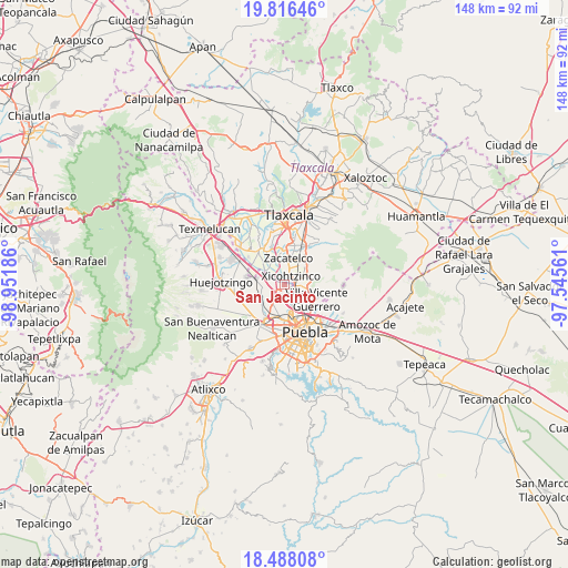
San Jacinto GPS coordinates[2]
19° 9' 12.996" North, 98° 14' 55.428" West
| Map corner | latitude | longitude |
|---|---|---|
| Upper-left | 19.81646°, | -98.95186° |
| Center: | 19.15361°, | -98.24873° |
| Lower-right: | 18.48808°, | -97.54561° |
| Map W x H: | 147.7×147.7 km | = 91.8×91.8mi |
| max Lat: | 32.7° ⇑62.1% North |
| San Jacinto: | 19.15361° |
| min Lat: | ⇓37.9% South 14.53588° |
| min Long | San Jacinto | max Long |
| -117.105° | -98.24873° | -86.73105° |
| W 60.6%⇐ | ⇒39.4% E |
Elevation
Elevation of San Jacinto is 2180 m = 7152 ft, and this is 926.3 m = 3039 ft above average elevation for this country.
| Max E: |
3497 m = 11473 ft | 18.4% |
| San Jacinto | 2180 m 7152 ft | |
| Avg. | 1253.7 m = 4113 ft | |
Min E: |
-1 m = -3 ft | 81.6% |
See also: Mexico elevation on elevation.city.
Geographical zone
San Jacinto is located in North Torrid zone (between Equator and Tropic of Cancer). Distance of this Northern Tropic circle is 476.2 km =295.9 mi to North.| Distance of | km | miles | from San Jacinto |
|---|---|---|---|
| North Pole | 7877.4 | 4894.8 | to North |
| Arctic Circle | 5271.5 | 3275.6 | to North |
| Tropic Cancer | 476.2 | 295.9 | to North |
| Equator | 2129.7 | 1323.3 | to South |


Nearby cities:
15 places around San Jacinto: (largest is in red/bold)
• Almecatla
1.8 km =1.1 mi,  131°
131°
• Coronango
7 km =4.3 mi,  238°
238°
• La Trinidad Chautenco
7.2 km =4.5 mi,  192°
192°
• Mazatecochco
7.1 km =4.4 mi,  66°
66°
• Papalotla
5 km =3.1 mi, 70°
• San Antonio Mihuacán
5.9 km =3.7 mi,  269°
269°
• San Francisco Ocotlán
4.2 km =2.6 mi, 239°
• San Marcos Contla
7.2 km =4.5 mi,  45°
45°
• San Miguel Xoxtla
6.4 km =4 mi,  284°
284°
• Sanctorum
6.1 km =3.8 mi, 185°
• Santa Catarina Ayometla
6.2 km =3.9 mi,  36°
36°
• Santa Cruz Quilehtla
7.4 km =4.6 mi,  22°
22°
• Tenancingo
5 km =3.1 mi,  98°
98°
• Xicohtzinco
2.7 km =1.7 mi, 35°
• Zacatelco
7 km =4.3 mi,  7°
7°
Sources, notices
• [Note1] Compared only with cities in Mexico existing in our database
• [Src1] Map data: © OpenStreetMap contributors (CC-BY-SA)
• [Src2] Other city data from geonames.org with taken over terms of usage.
• [Src3] Geographical zone / Annual Mean Temperature by Robert A. Rohde @ Wikipedia
