San Ciro de Acosta geodata
San Ciro de Acosta (San Luis Potosí) is a seat of a second-order administrative division; located in Mexico in America/Mexico_City (GMT-6) time zone. With population of 7,026 people, there are 1321 cities with bigger population in this country. Compared to other cities in Mexico, 82.1% of cities are located further ↓South; 61.7% of cities are located further →East and 61.4% of cities have higher elevation than San Ciro de Acosta. Note1


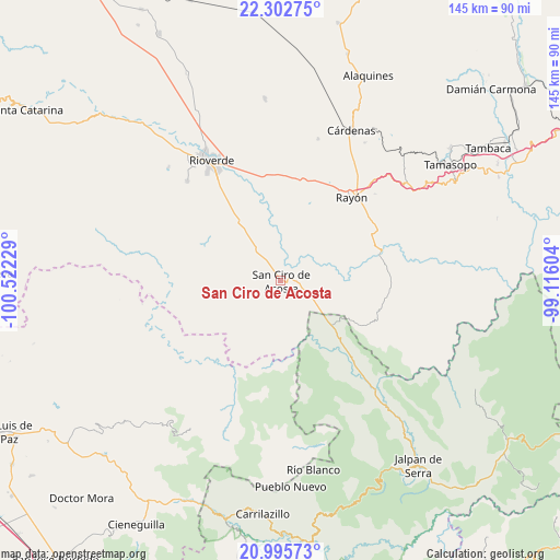
San Ciro de Acosta GPS coordinates[2]
21° 39' 2.592" North, 99° 49' 8.976" West
| Map corner | latitude | longitude |
|---|---|---|
| Upper-left | 22.30275°, | -100.52229° |
| Center: | 21.65072°, | -99.81916° |
| Lower-right: | 20.99573°, | -99.11604° |
| Map W x H: | 145.3×145.3 km | = 90.3×90.3mi |
| max Lat: | 32.7° ⇑17.9% North |
| San Ciro de Acosta: | 21.65072° |
| min Lat: | ⇓82.1% South 14.53588° |
| min Long | San Ciro de Aco | max Long |
| -117.105° | -99.81916° | -86.73105° |
| W 38.3%⇐ | ⇒61.7% E |
Elevation
Elevation of San Ciro de Acosta is 910 m = 2986 ft, and this is 343.7 m = 1128 ft below average elevation for this country.
| Max E: |
3497 m = 11473 ft | 61.4% |
| Avg. | 1253.7 m = 4113 ft | |
| San Ciro de Acosta | 910 m = 2986 ft | |
Min E: |
-1 m = -3 ft | 38.6% |
See also: Mexico elevation on elevation.city.
Geographical zone
San Ciro de Acosta is located in North Torrid zone (between Equator and Tropic of Cancer). Distance of this Northern Tropic circle is 198.6 km =123.4 mi to North.| Distance of | km | miles | from San Ciro de Acosta |
|---|---|---|---|
| North Pole | 7599.7 | 4722.2 | to North |
| Arctic Circle | 4993.8 | 3103 | to North |
| Tropic Cancer | 198.6 | 123.4 | to North |
| Equator | 2407.3 | 1495.8 | to South |


Nearby cities:
15 places around San Ciro de Acosta: (largest is in red/bold)
• Arroyo Seco
17.7 km =11 mi,  130°
130°
• Cerrito de la Cruz
28.8 km =17.9 mi,  22°
22°
• Concá
29.7 km =18.5 mi,  140°
140°
• El Capulín
30 km =18.6 mi,  311°
311°
• El Pajarito
17 km =10.6 mi,  60°
60°
• El Zapote
21.5 km =13.4 mi,  289°
289°
• Lagunillas
27 km =16.8 mi,  104°
104°
• Las Magdalenas
25.7 km =16 mi,  326°
326°
• Miguel Hidalgo
27.9 km =17.3 mi,  342°
342°
• Pinihuan
26.7 km =16.6 mi,  75°
75°
• Plazuela
20.1 km =12.5 mi,  324°
324°
• Puerto de Martínez
9.4 km =5.8 mi, 316°
• Rayón
28.1 km =17.5 mi,  40°
40°
• San José del Tapanco
16.2 km =10.1 mi, 325°
• San Rafael
13.4 km =8.3 mi,  120°
120°
Sources, notices
• [Note1] Compared only with cities in Mexico existing in our database
• [Src1] Map data: © OpenStreetMap contributors (CC-BY-SA)
• [Src2] Other city data from geonames.org with taken over terms of usage.
• [Src3] Geographical zone / Annual Mean Temperature by Robert A. Rohde @ Wikipedia
