Plazuela geodata
Plazuela (San Luis Potosí) is a populated place; located in Mexico in America/Mexico_City (GMT-6) time zone. With population of 683 people, there are 12712 cities with bigger population in this country. Compared to other cities in Mexico, 82.9% of cities are located further ↓South; 63% of cities are located further →East and 60.9% of cities have higher elevation than Plazuela. Note1


Plazuela GPS coordinates[2]
21° 47' 54.996" North, 99° 55' 51.888" West
| Map corner | latitude | longitude |
|---|---|---|
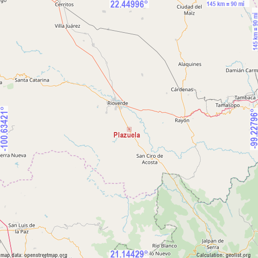
| Upper-left | 22.44996°, | -100.63421° |
| Center: | 21.79861°, | -99.93108° |
| Lower-right: | 21.14429°, | -99.22796° |
| Map W x H: | 145.2×145.2 km | = 90.2×90.2mi |
| max Lat: | 32.7° ⇑17.1% North |
| Plazuela: | 21.79861° |
| min Lat: | ⇓82.9% South 14.53588° |
| min Long | Plazuela | max Long |
| -117.105° | -99.93108° | -86.73105° |
| W 37%⇐ | ⇒63% E |
Elevation
Elevation of Plazuela is 942 m = 3091 ft, and this is 311.7 m = 1023 ft below average elevation for this country.
| Max E: |
3497 m = 11473 ft | 60.9% |
| Avg. | 1253.7 m = 4113 ft | |
| Plazuela | 942 m = 3091 ft | |
Min E: |
-1 m = -3 ft | 39.1% |
See also: Mexico elevation on elevation.city.
Geographical zone
Plazuela is located in North Torrid zone (between Equator and Tropic of Cancer). Distance of this Northern Tropic circle is 182.1 km =113.2 mi to North.| Distance of | km | miles | from Plazuela |
|---|---|---|---|
| North Pole | 7583.3 | 4712 | to North |
| Arctic Circle | 4977.4 | 3092.8 | to North |
| Tropic Cancer | 182.1 | 113.2 | to North |
| Equator | 2423.8 | 1506.1 | to South |


Nearby cities:
15 places around Plazuela: (largest is in red/bold)
• Ciudad Fernández
17.8 km =11.1 mi,  332°
332°
• El Capulín
11.5 km =7.1 mi,  286°
286°
• El Jabalí
15.8 km =9.8 mi,  307°
307°
• El Pescadito
18.8 km =11.7 mi,  296°
296°
• El Zapote
12.7 km =7.9 mi,  223°
223°
• Ildefonso Turrubiartes (La Boquilla)
15.6 km =9.7 mi,  24°
24°
• La Loma
20.5 km =12.7 mi, 301°
• Las Magdalenas
5.6 km =3.5 mi, 330°
• Miguel Hidalgo
10.5 km =6.5 mi, 16°
• Ojo de Agua Seco
15.5 km =9.6 mi, 292°
• Puerto de Martínez
10.9 km =6.8 mi,  151°
151°
• Rioverde
16.1 km =10 mi,  335°
335°
• San Ciro de Acosta
20.1 km =12.5 mi,  144°
144°
• San Diego
21.9 km =13.6 mi, 306°
• San José del Tapanco
3.9 km =2.4 mi, 142°
Sources, notices
• [Note1] Compared only with cities in Mexico existing in our database
• [Src1] Map data: © OpenStreetMap contributors (CC-BY-SA)
• [Src2] Other city data from geonames.org with taken over terms of usage.
• [Src3] Geographical zone / Annual Mean Temperature by Robert A. Rohde @ Wikipedia
