San Andrés Huaxpaltepec geodata
San Andrés Huaxpaltepec (Oaxaca) is a seat of a second-order administrative division; located in Mexico in America/Mexico_City (GMT-6) time zone. With population of 4,146 people, there are 2209 cities with bigger population in this country. Compared to other cities in Mexico, 95.5% of cities are located further ↑North; 64.6% of cities are located further ←West and 74.6% of cities have higher elevation than San Andrés Huaxpaltepec. Note1
Current local time in San Andrés Huaxpaltepec:
10:25 AM, MondayDifference from your time zone: hours


San Andrés Huaxpaltepec GPS coordinates[2]
16° 19' 46.272" North, 97° 54' 59.292" West
| Map corner | latitude | longitude |
|---|---|---|
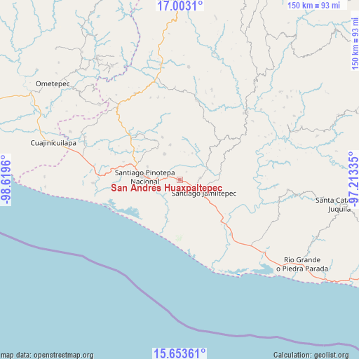
| Upper-left | 17.0031°, | -98.6196° |
| Center: | 16.32952°, | -97.91647° |
| Lower-right: | 15.65361°, | -97.21335° |
| Map W x H: | 150×150.1 km | = 93.2×93.3mi |
| max Lat: | 32.7° ⇑95.5% North |
| San Andrés Huaxpaltepec: | 16.32952° |
| min Lat: | ⇓4.5% South 14.53588° |
| min Long | San Andrés Hua | max Long |
| -117.105° | -97.91647° | -86.73105° |
| W 64.6%⇐ | ⇒35.4% E |
Elevation
Elevation of San Andrés Huaxpaltepec is 233 m = 764 ft, and this is 1020.7 m = 3349 ft below average elevation for this country.
| Max E: |
3497 m = 11473 ft | 74.6% |
| Avg. | 1253.7 m = 4113 ft | |
| San Andrés Huaxpaltepec | 233 m = 764 ft | |
Min E: |
-1 m = -3 ft | 25.4% |
See also: Mexico elevation on elevation.city.
Geographical zone
San Andrés Huaxpaltepec is located in North Torrid zone (between Equator and Tropic of Cancer). Distance of this Northern Tropic circle is 790.2 km =491 mi to North.| Distance of | km | miles | from San Andrés Huaxpaltepec |
|---|---|---|---|
| North Pole | 8191.4 | 5089.9 | to North |
| Arctic Circle | 5585.5 | 3470.7 | to North |
| Tropic Cancer | 790.2 | 491 | to North |
| Equator | 1815.7 | 1128.2 | to South |


Nearby cities:
15 places around San Andrés Huaxpaltepec: (largest is in red/bold)
• Cruz del Itacuán
12.4 km =7.7 mi,  247°
247°
• Cubitán de Dolores
4.3 km =2.7 mi,  38°
38°
• Jamiltepec
11.1 km =6.9 mi,  117°
117°
• José María Morelos
14 km =8.7 mi,  185°
185°
• Paso del Jiote
13.4 km =8.3 mi,  199°
199°
• Piedra Blanca
11.5 km =7.1 mi,  228°
228°
• Pinotepa de Don Luis
12.6 km =7.8 mi,  329°
329°
• Rancho Viejo
5.2 km =3.2 mi,  282°
282°
• San Juan Yosocani
11.8 km =7.3 mi,  8°
8°
• San Lorenzo
8.6 km =5.3 mi,  31°
31°
• San Miguel Tetepelcingo
7.8 km =4.8 mi, 12°
• Santa Catarina Mechoacán
8.5 km =5.3 mi,  85°
85°
• Santa Elena Comaltepec
12.6 km =7.8 mi,  95°
95°
• Santa María Huazolotitlán
2.9 km =1.8 mi,  172°
172°
• Santa María Yosocani
12.2 km =7.6 mi,  24°
24°
Sources, notices
• [Note1] Compared only with cities in Mexico existing in our database
• [Src1] Map data: © OpenStreetMap contributors (CC-BY-SA)
• [Src2] Other city data from geonames.org with taken over terms of usage.
• [Src3] Geographical zone / Annual Mean Temperature by Robert A. Rohde @ Wikipedia
