Cubitán de Dolores geodata
Cubitán de Dolores (Oaxaca) is a populated place; located in Mexico in America/Mexico_City (GMT-6) time zone. With population of 632 people, there are 13699 cities with bigger population in this country. Compared to other cities in Mexico, 95.2% of cities are located further ↑North; 65% of cities are located further ←West and 74.4% of cities have higher elevation than Cubitán de Dolores. Note1


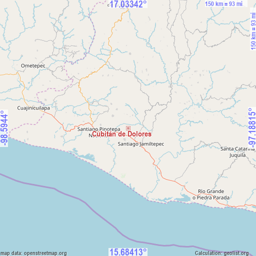
Cubitán de Dolores GPS coordinates[2]
16° 21' 35.784" North, 97° 53' 28.572" West
| Map corner | latitude | longitude |
|---|---|---|
| Upper-left | 17.03342°, | -98.5944° |
| Center: | 16.35994°, | -97.89127° |
| Lower-right: | 15.68413°, | -97.18815° |
| Map W x H: | 150×150 km | = 93.2×93.2mi |
| max Lat: | 32.7° ⇑95.2% North |
| Cubitán de Dolores: | 16.35994° |
| min Lat: | ⇓4.8% South 14.53588° |
| min Long | Cubitán de Dol | max Long |
| -117.105° | -97.89127° | -86.73105° |
| W 65%⇐ | ⇒35% E |
Elevation
Elevation of Cubitán de Dolores is 241 m = 791 ft, and this is 1012.7 m = 3323 ft below average elevation for this country.
| Max E: |
3497 m = 11473 ft | 74.4% |
| Avg. | 1253.7 m = 4113 ft | |
| Cubitán de Dolores | 241 m = 791 ft | |
Min E: |
-1 m = -3 ft | 25.6% |
See also: Mexico elevation on elevation.city.
Geographical zone
Cubitán de Dolores is located in North Torrid zone (between Equator and Tropic of Cancer). Distance of this Northern Tropic circle is 786.9 km =489 mi to North.| Distance of | km | miles | from Cubitán de Dolores |
|---|---|---|---|
| North Pole | 8188 | 5087.8 | to North |
| Arctic Circle | 5582.1 | 3468.6 | to North |
| Tropic Cancer | 786.9 | 489 | to North |
| Equator | 1819.1 | 1130.3 | to South |


Nearby cities:
15 places around Cubitán de Dolores: (largest is in red/bold)
• Jamiltepec
11.2 km =7 mi,  140°
140°
• Pinotepa de Don Luis
11.8 km =7.3 mi,  309°
309°
• Rancho Viejo
8.1 km =5 mi,  253°
253°
• San Agustín Chayuco
10 km =6.2 mi,  61°
61°
• San Andrés Huaxpaltepec
4.3 km =2.7 mi,  218°
218°
• San Juan Colorado
13.1 km =8.1 mi,  329°
329°
• San Juan Yosocani
8.3 km =5.2 mi,  353°
353°
• San Lorenzo
4.3 km =2.7 mi,  25°
25°
• San Miguel Tetepelcingo
4.4 km =2.7 mi, 345°
• Santa Catarina Mechoacán
6.4 km =4 mi,  114°
114°
• Santa Elena Comaltepec
10.9 km =6.8 mi, 114°
• Santa María Huazolotitlán
6.7 km =4.2 mi,  200°
200°
• Santa María Nutío
14 km =8.7 mi, 354°
• Santa María Yosocani
8.1 km =5 mi,  17°
17°
• Siniyuvi
13.5 km =8.4 mi,  343°
343°
Sources, notices
• [Note1] Compared only with cities in Mexico existing in our database
• [Src1] Map data: © OpenStreetMap contributors (CC-BY-SA)
• [Src2] Other city data from geonames.org with taken over terms of usage.
• [Src3] Geographical zone / Annual Mean Temperature by Robert A. Rohde @ Wikipedia
